Garmin - Tread 2 - Overland Edition Powersport Navigator 8" GPS with Built-In Bluetooth - Black
Model: 010-03021-00
SKU: 12570164
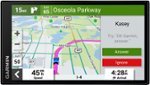
Roam the unknown with the rugged Tread 2 – Overland Edition all-terrain navigator for true expeditioners. The 8” high-resolution, ultrabright and glove-friendly touchscreen will show you the way. Get turn-by-turn navigation for unpaved roads and trails for the kinds of places you love to travel. Venture on- and off-road with high-definition digital elevation maps, private and public land boundaries, and City Navigator maps. View preloaded topographic maps with 3D terrain for North and South America in addition to custom street routing in North America, based on the size and weight of your rig (not available in all areas; always defer to posted road signs and road conditions). Download subscription-free satellite imagery for high-resolution overhead views of routes and terrain (requires a connection with Wi-Fi technology). Use the preloaded directory of Ultimate Public Campgrounds to find good overnight stops along your route. Support for Outdoor Maps+ (subscription required) allows ongoing access to additional premium map content including burn zones, night lights and more. Plan trips easily with the Tread app on your compatible smartphone. And pair with a Garmin PowerSwitch digital switch box (sold separately) for convenient control of your vehicle’s 12-volt electronics — including light bars, differential locks and more — right from your Tread 2 touchscreen.
The 8-inch high-resolution, ultrabright and glove-friendly touchscreen navigator is purpose-built to withstand extreme temperatures and weather (IP67 dust/water rating) for rugged off-road adventures. The heavy-duty mounting hardware withstands high vibration and shock. Plus, the upgraded processor delivers faster performance, including map drawing and route calculations.
Get turn-by-turn trail navigation for unpaved roads and trails in off-road riding areas with OpenStreetMap, U.S. Forest Service Motor Vehicle Use Maps, and Adventure Roads and Trails map content. In North America, view off-road riding areas with trail difficulty ratings.
Download subscription-free satellite imagery directly to the device via Wi-Fi technology to see high-resolution overhead views of routes and terrain.
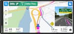
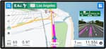
Get City Navigator maps of North America with custom street routing for the size and weight of your rig. Plus, receive alerts for potential hazards along your route, including sharp curves, speed changes and more.
Find great rides for off-road; discover the best places to explore, bookmark them to sync with your navigator, rate difficulty, and upload pics (requires use of the Tread smartphone app).
Purchase an Outdoor Maps+ subscription for ongoing access to a wide variety of premium mapping content, including burn zones, night lights and more.
Access public land boundaries for national forests, Bureau of Land Management, wilderness areas and more. Also, see private land boundaries and landowner information for parcels greater than 4 acres.
Pair your Tread 2 – Overland Edition with your compatible inReach global satellite communicator for two-way text messaging, interactive SOS and weather. With select devices, you can even send photo and voice messages.

Reviews coming soon
Reviews coming soon