Garmin - Tread 2 - SxS Edition Powersport Navigator 8" GPS with Built-In Bluetooth - Black
Model: 010-03021-01
SKU: 12229295
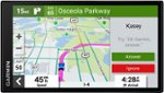
Roam the unknown with the rugged Tread 2 – SxS Edition powersport navigator. The 8” high-resolution, ultrabright and glove-friendly touchscreen will show you the way in extreme terrain, temperatures and weather (IP67 dust/water rating). Get turn-by-turn navigation for unpaved roads and trails for the kinds of places you love to ride. Venture on- and off-road with high-definition digital elevation maps, private and public land boundaries, and more. Find new places to explore with the great rides feature for off-road (searches require use of the Tread smartphone app). Download satellite imagery for high-resolution overhead views of routes and terrain (requires a connection with Wi-Fi technology). Support for Outdoor Maps+ (subscription required) allows ongoing access to additional premium map content, including burn zones, night lights and more. Track your friends’ locations with the Tread app via the group ride mobile feature when downloaded to your and each friend’s compatible smartphones enabled with BLUETOOTH technology (requires active cellular connections). Or, pair Tread 2 with the Group Ride Radio accessory for voice communication and tracking outside of a cellular network (sold separately; group tracking is available for riders using a compatible Garmin navigator and requires connection to vehicle power).
The 8-inch high-resolution, ultrabright and glove-friendly touchscreen navigator is purpose-built to withstand extreme temperatures and weather (IP67 dust/water rating) for rugged off-road adventures. Tread 2 includes a roll cage mount and bare wire power cable. Plus, the upgraded processor with a 10 Hz GPS receiver delivers faster performance, including map drawing and route calculations.
Get turn-by-turn trail navigation for unpaved roads and trails in off-road riding areas with OpenStreetMap, U.S. Forest Service Motor Vehicle Use Maps, and Adventure Roads and Trails map content1. In North America, view off-road riding areas with trail difficulty ratings. When you head back to civilization, get directions on streets, options for more scenic routes and driver alerts for upcoming potential hazards.
Download subscription-free satellite imagery directly to the device via Wi-Fi technology to see high-resolution overhead views of routes and terrain.
Find best-rated rides for off-road; discover new places to explore, bookmark them to sync with your navigator, rate difficulty, and upload pics (requires use of the Tread smartphone app).
Track friends from your compatible smartphone or Tread device when you and your friends use the Tread app’s group ride mobile feature.
Purchase an Outdoor Maps+ subscription for ongoing access to a wide variety of premium mapping content, including burn zones, night lights and more.

Reviews coming soon
Reviews coming soon