A:AnswerNo, this model is designed for passenger vehicles and doesn’t include any truck specific routing. The Garmin dēzl™ series includes detailed maps for North America that include truck-related restrictions – like bridge heights, sharp curves, weight limits and more – and related information for most major roads and highways.
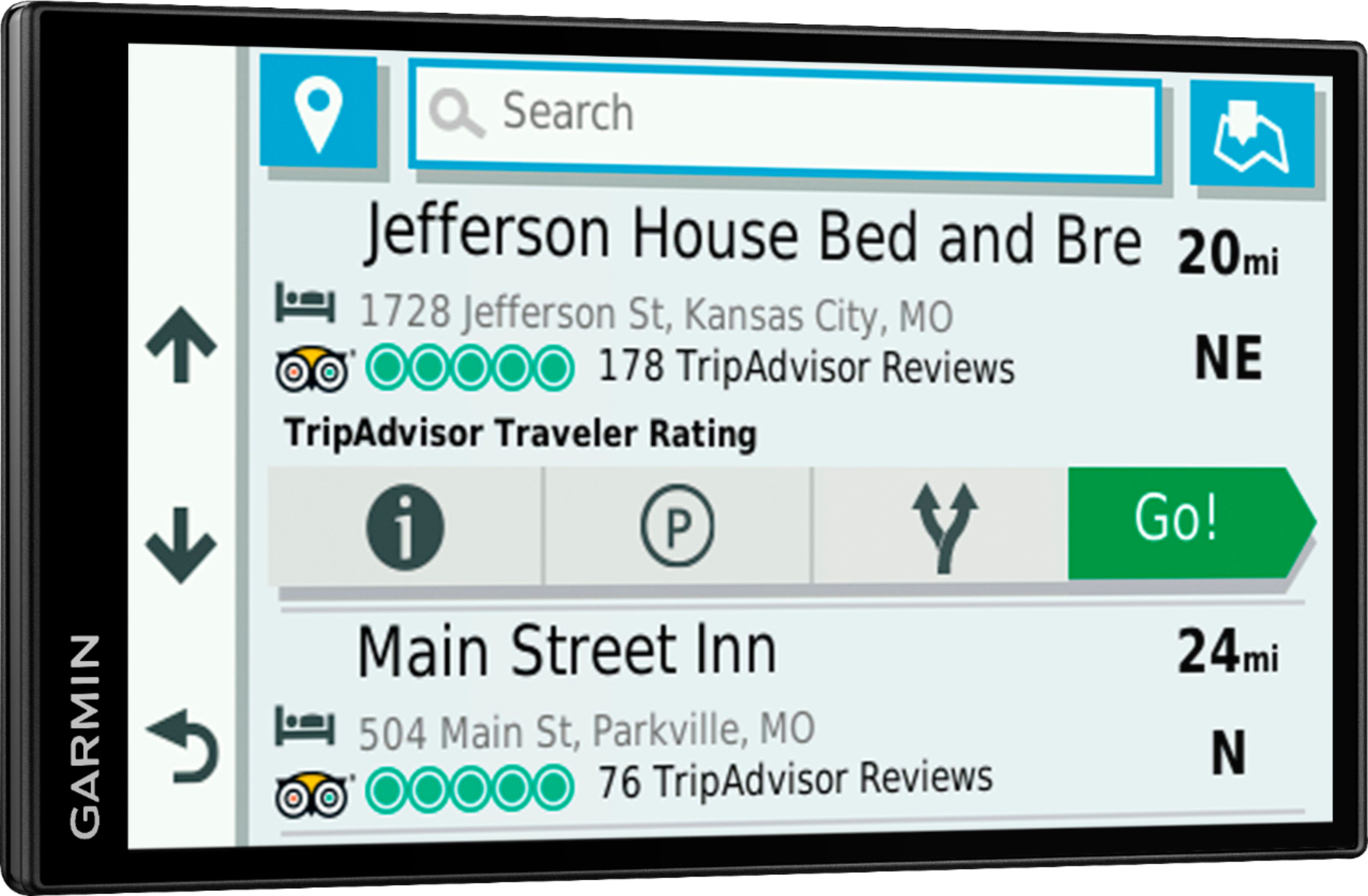
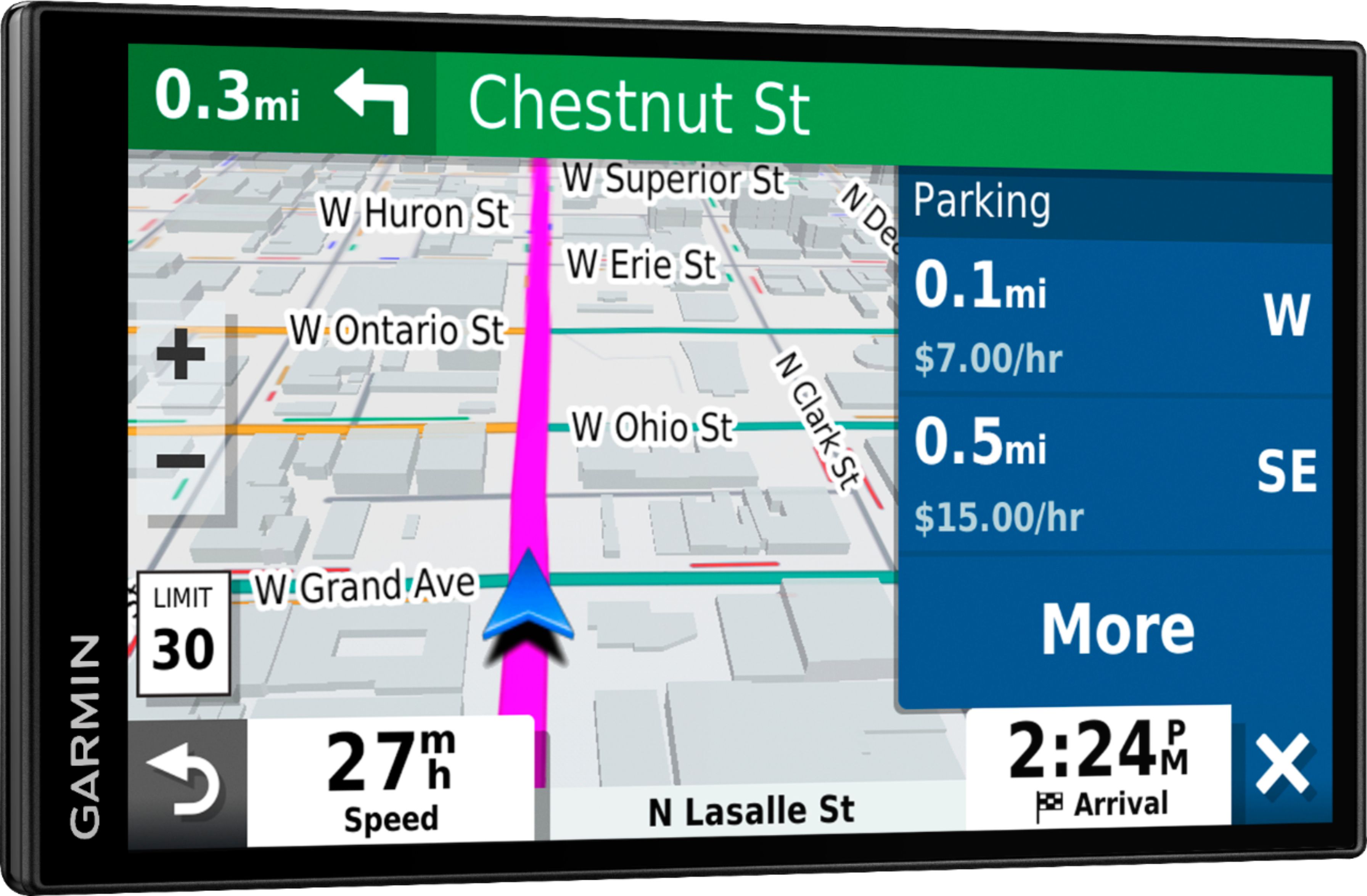
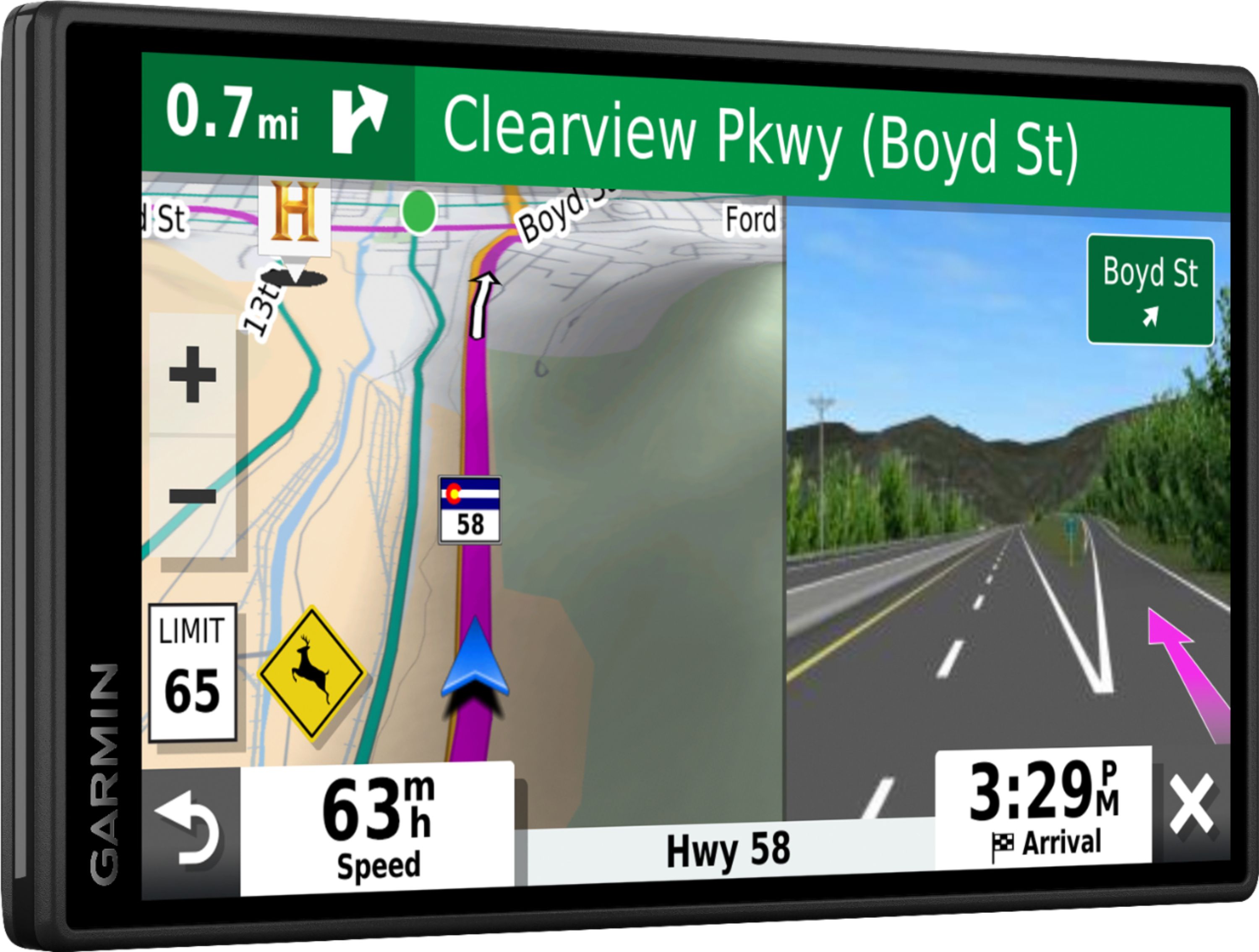
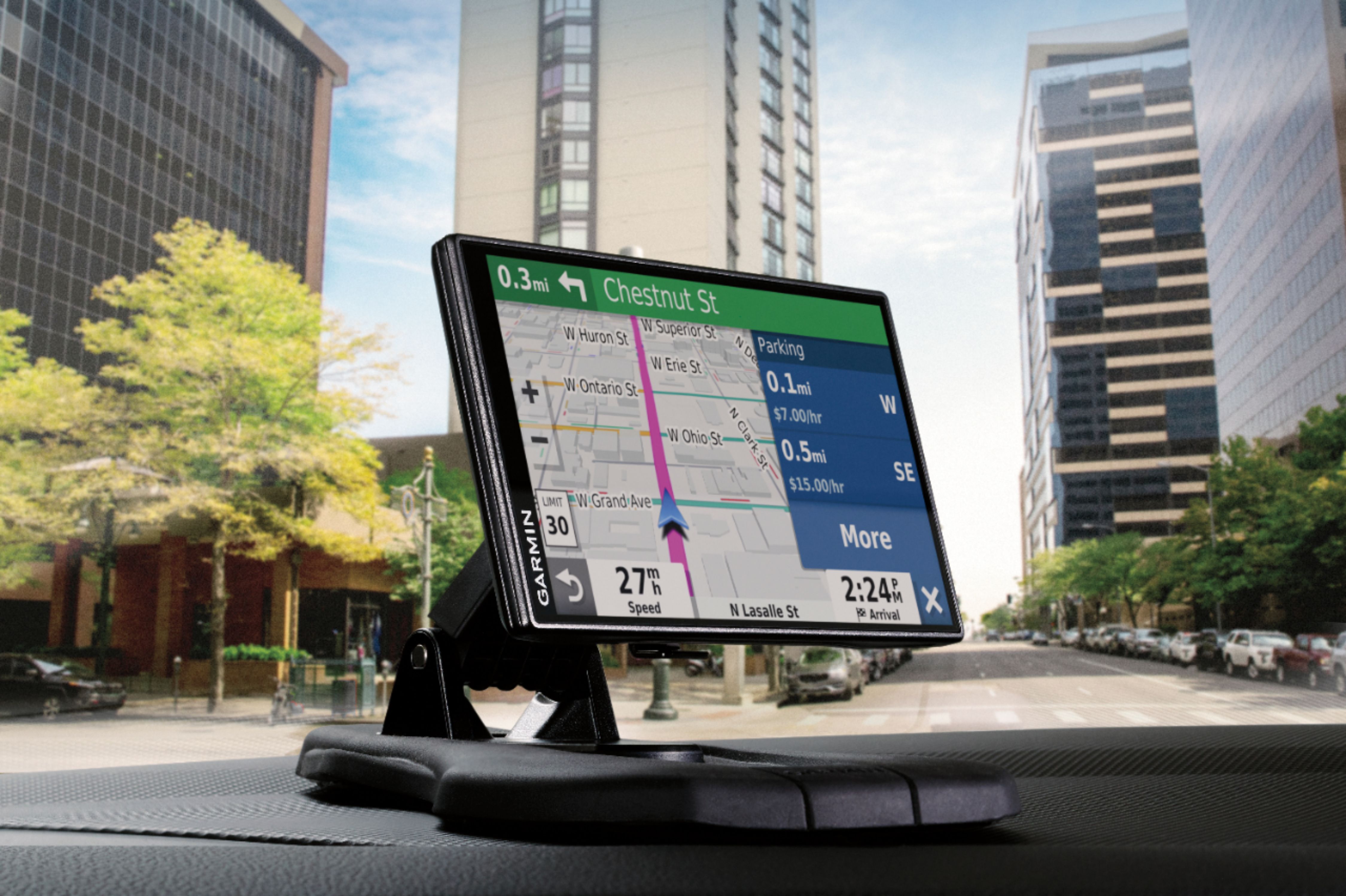
A:AnswerYes, it provides the name of the streets as well as the street you are on. It connects via Bluetooth to your phone by way of their app. You can type the digits then the first three letters of the address then it populates a list of possible locations, usually the address you are searching for is the first to appear. Its very convenient to be able to type the address on your phone and not have to reach for the device. The blue tooth connection also can be used as a speaker to accept calls from your phone providing has free conversations. This is by far the best portable GPS unit I have owned.
A:AnswerNo, Garmin does not recommend using anything other than a zumo device on a motorcycle. This model is not water resistant and has not been vibration tested for use on a motorcycle.
A:AnswerThe newest Garmin I bought -
Yes it does most of the time! Shopping centers etc too! Only where there is a back Road that is not state owned! It shows how to head to get back to a Road so you will not stay on an unmarked road long!
A:AnswerNo, it’s a gps unit with its own display. Sounds like your asking if it has Apple car play. That would defeat the purpose of the product; it has its own large display and is self contained.
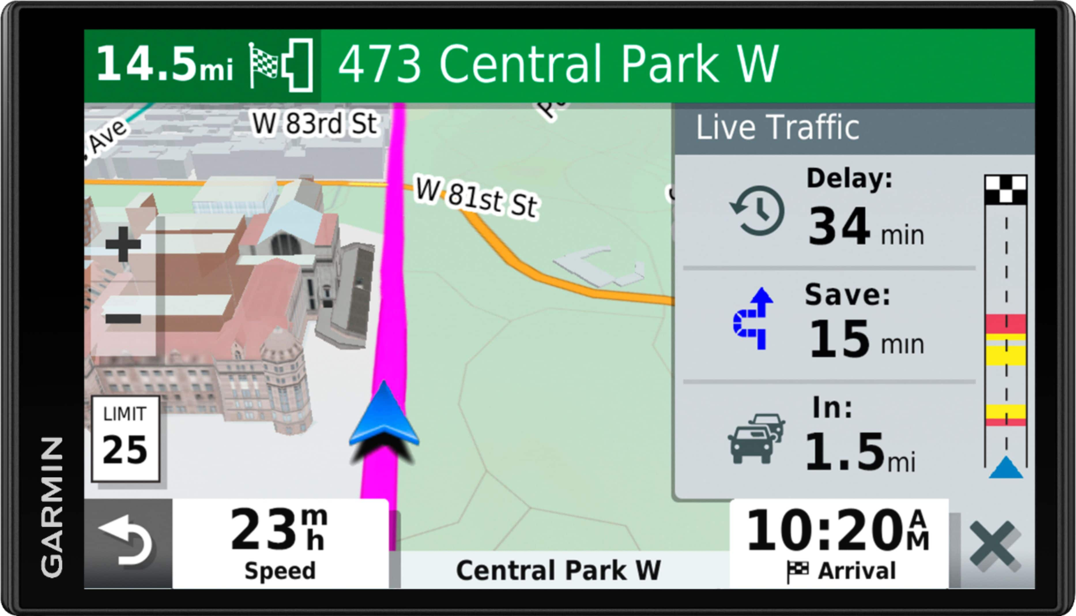
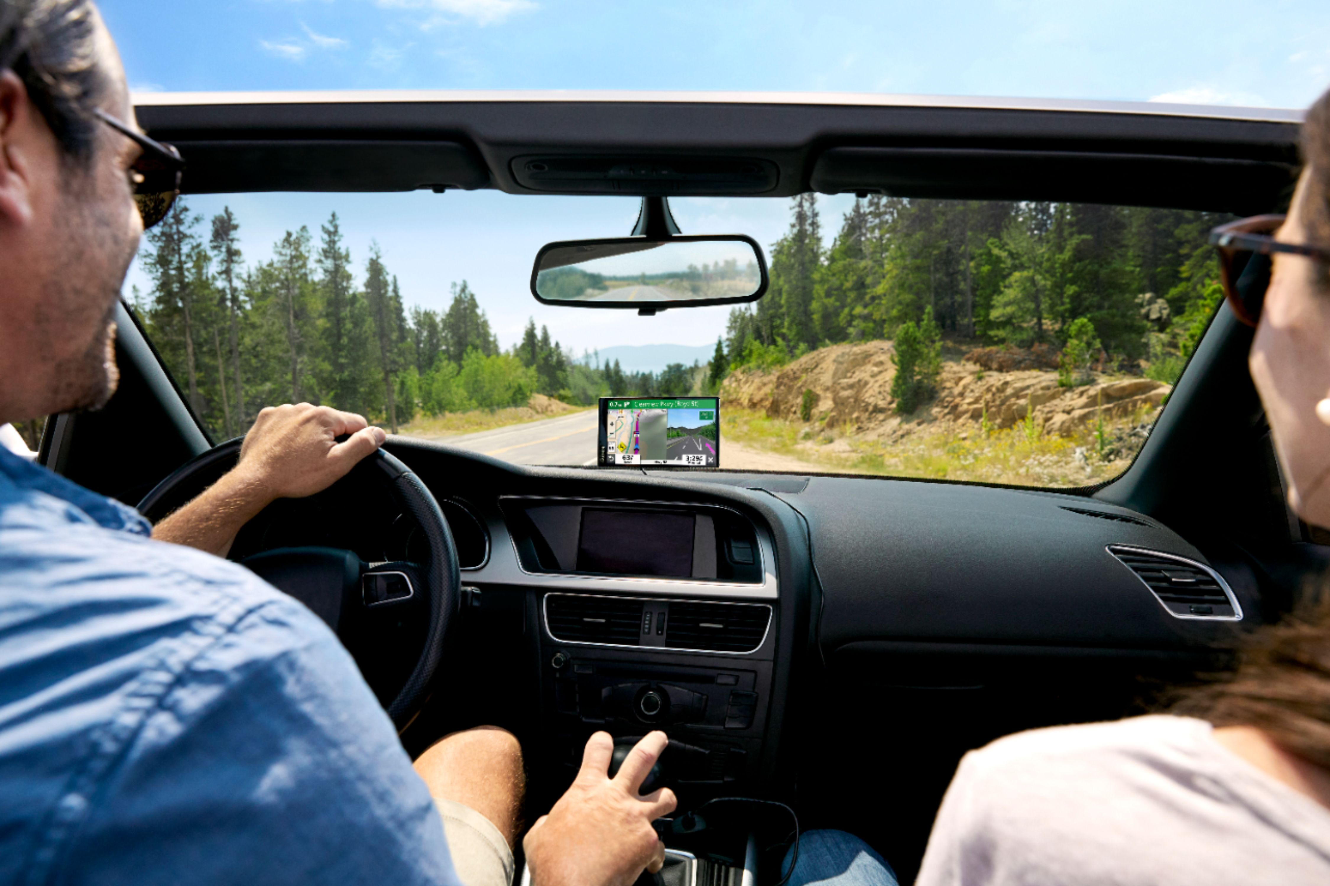
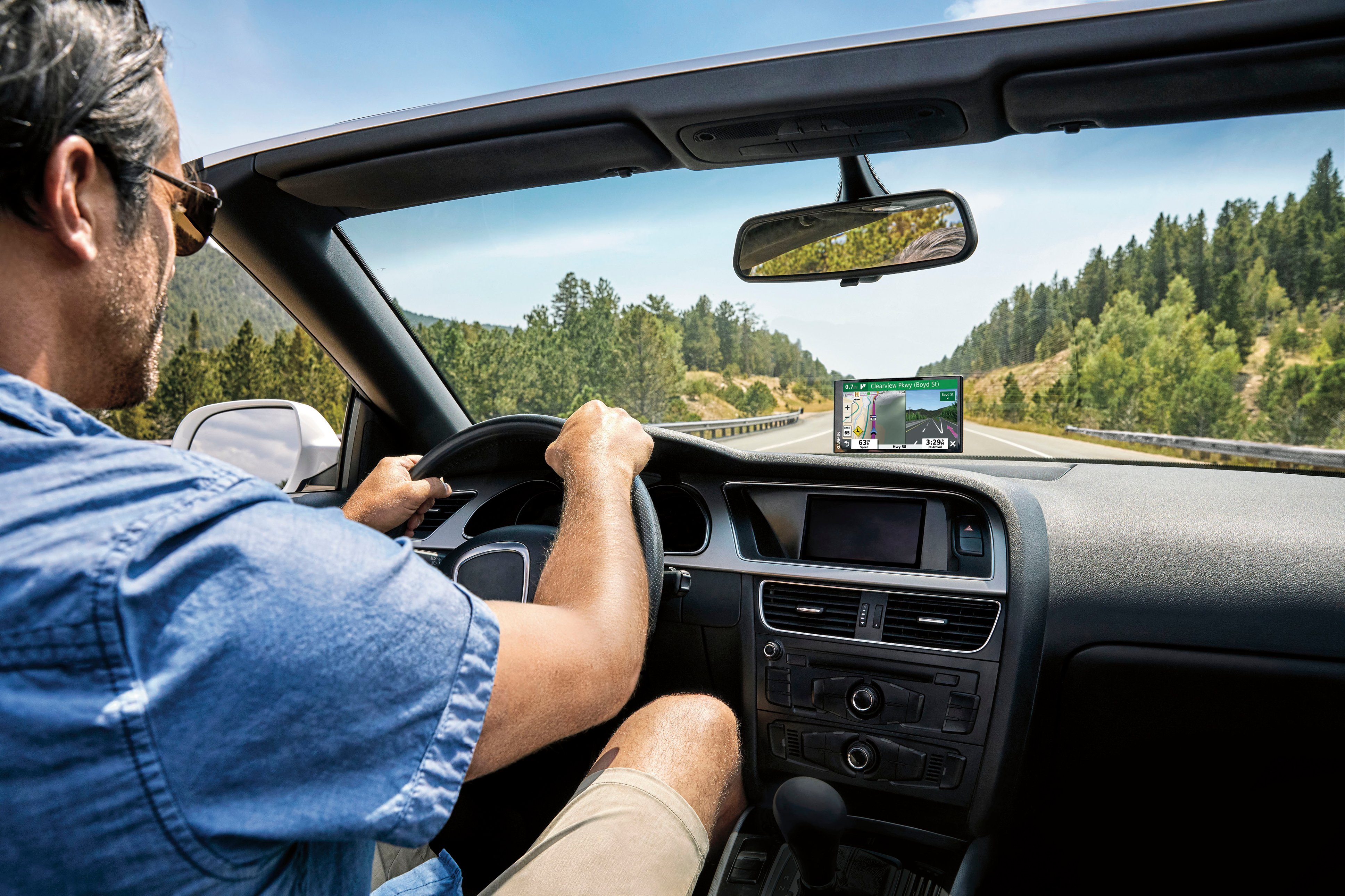
A:AnswerActually traffic info comes via the cable provided with the unit which plugs on the lighter plug of your car
Traffic info travels thanks to gps info from satellites
It uses wi fi to update maps info
A:AnswerThis model will display the elevation and the coordinates of your location. You can view the elevation in one of the Trip Data fields on the map screen.