Maps Gps
-
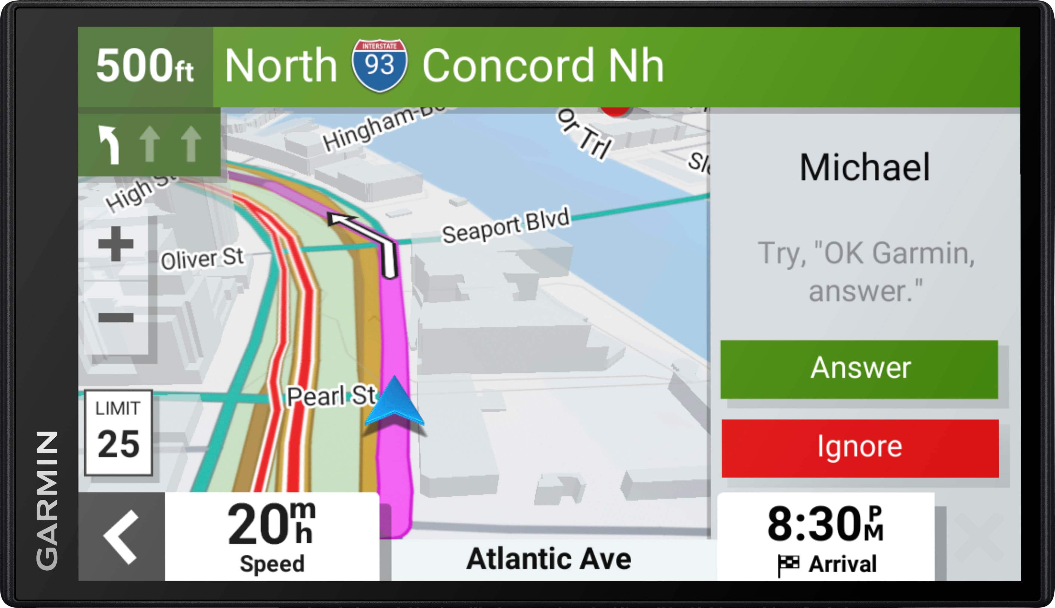
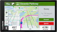
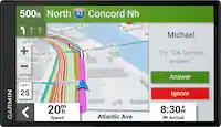
Garmin - DriveSmart 76 7" GPS with Built-In Bluetooth, Map Updates and Traffic Updates - Black
SKU: JXF9YFWTPQYou have to be care with that. When I was using the GPS it was giving me the directions to locations that could of took less time if the route was calculated different....The GPS Garmin SmartDrive 76...
See all Portable GPSProduct Description
A black GPS navigator with a 7" touchscreen, Bluetooth, Alexa integration, map updates, and live traffic alerts.Your price for this item is $249.99Save $50The previous price was $299.99 -
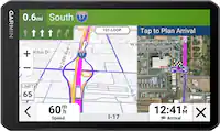
Garmin - Zumo XT2 6" GPS with Built-In Bluetooth and Map Updates - Black
SKU: JXF9YF4J97See all Portable GPSProduct Description
A rugged black GPS navigator with a 6" sunlight-readable touchscreen, Bluetooth, and customizable route planning.Your price for this item is $599.99 -
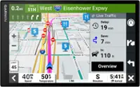
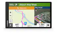
Garmin - RV 795 7" RV GPS Navigator - Black
SKU: JXF9YFZCWXNice smaller sized GPS...Our prior GPS was an 895. The fact that that it was bigger & contained more info was nice but GPS's don't seem to last more than a couple of years & we couldn't justify the extra...
See all Portable GPSProduct Description
A black GPS navigator with a 7" touchscreen, custom RV routing, and North America map updates.Your price for this item is $344.99Save $105The previous price was $449.99 -
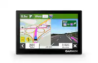
Garmin - RV 1095 10" GPS Navigator with Built-In Bluetooth - Black
SKU: JXF9YFZCZ3See all Portable GPSProduct Description
A black GPS navigator with a 10" touchscreen, Bluetooth, custom RV routing, and North America maps.Your price for this item is $869.95Save $30The previous price was $899.99 -
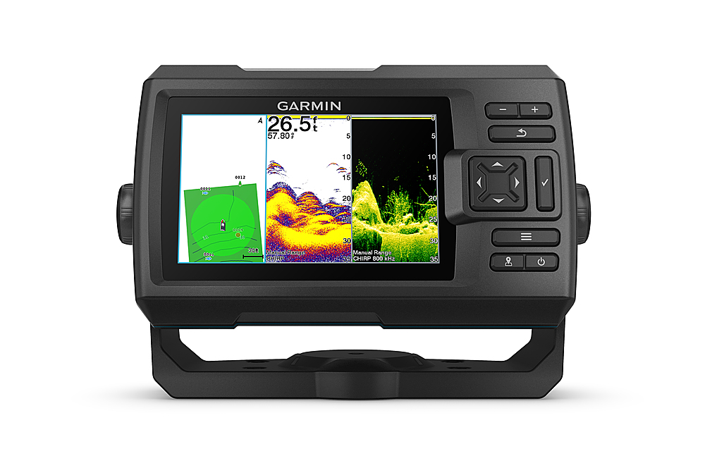
Garmin - STRIKER Vivid 5cv Fishfinder GPS - Black
SKU: JXF9YFWXG9See all Marine GPS & FishfindersProduct Description
A black fishfinder with high-contrast color display, CHIRP sonar, GPS, and Quickdraw Contours mapping.Your price for this item is $349.99 -
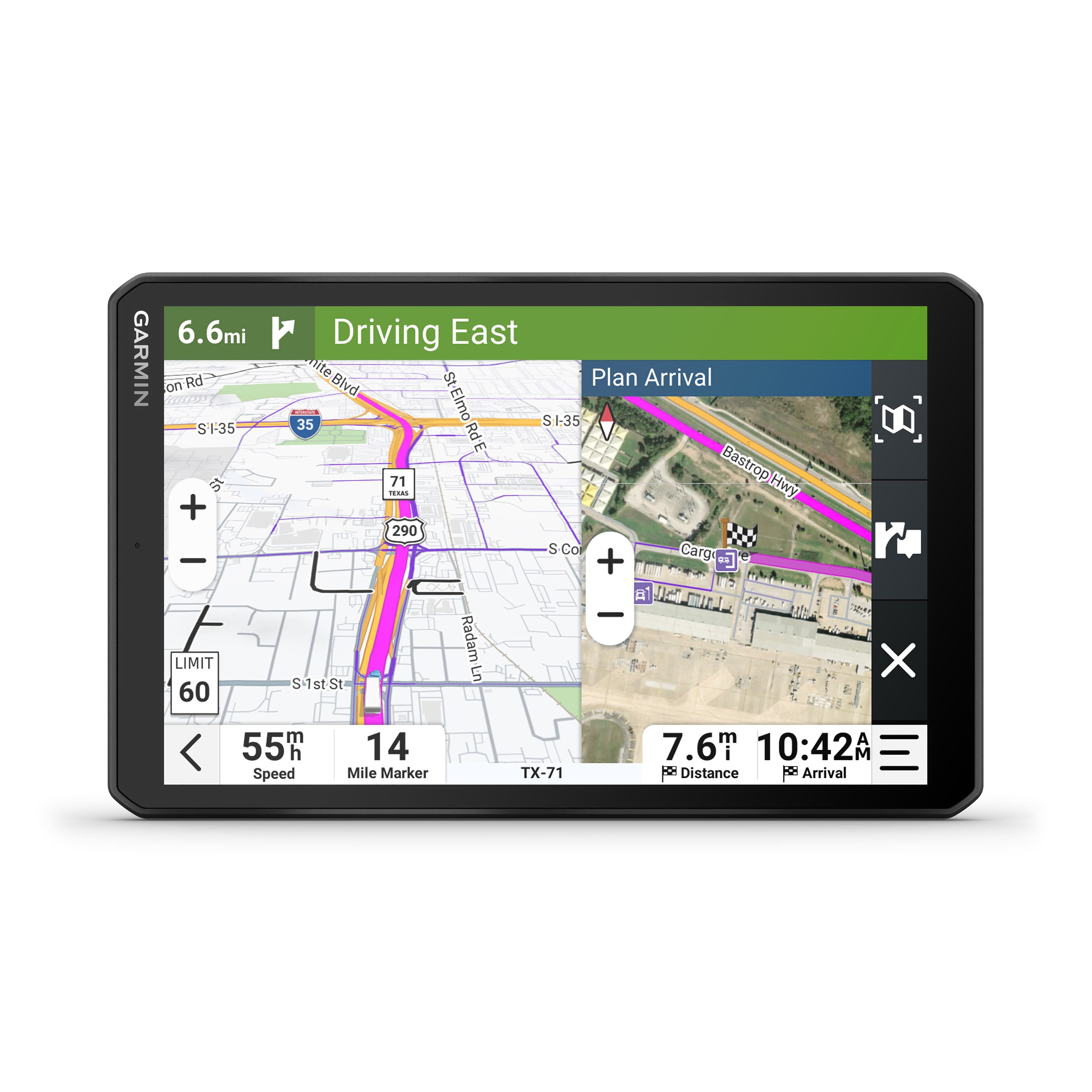
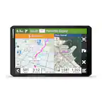
Garmin - dezl OTR 820 8" Trucking GPS - Black
SKU: JXF9YF5SH2See all Portable GPSProduct Description
A black touchscreen GPS offering custom truck routing, real-time weather, and trucker-rated location insights.Your price for this item is $699.99 -
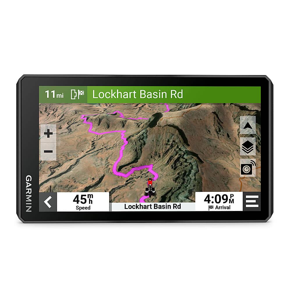
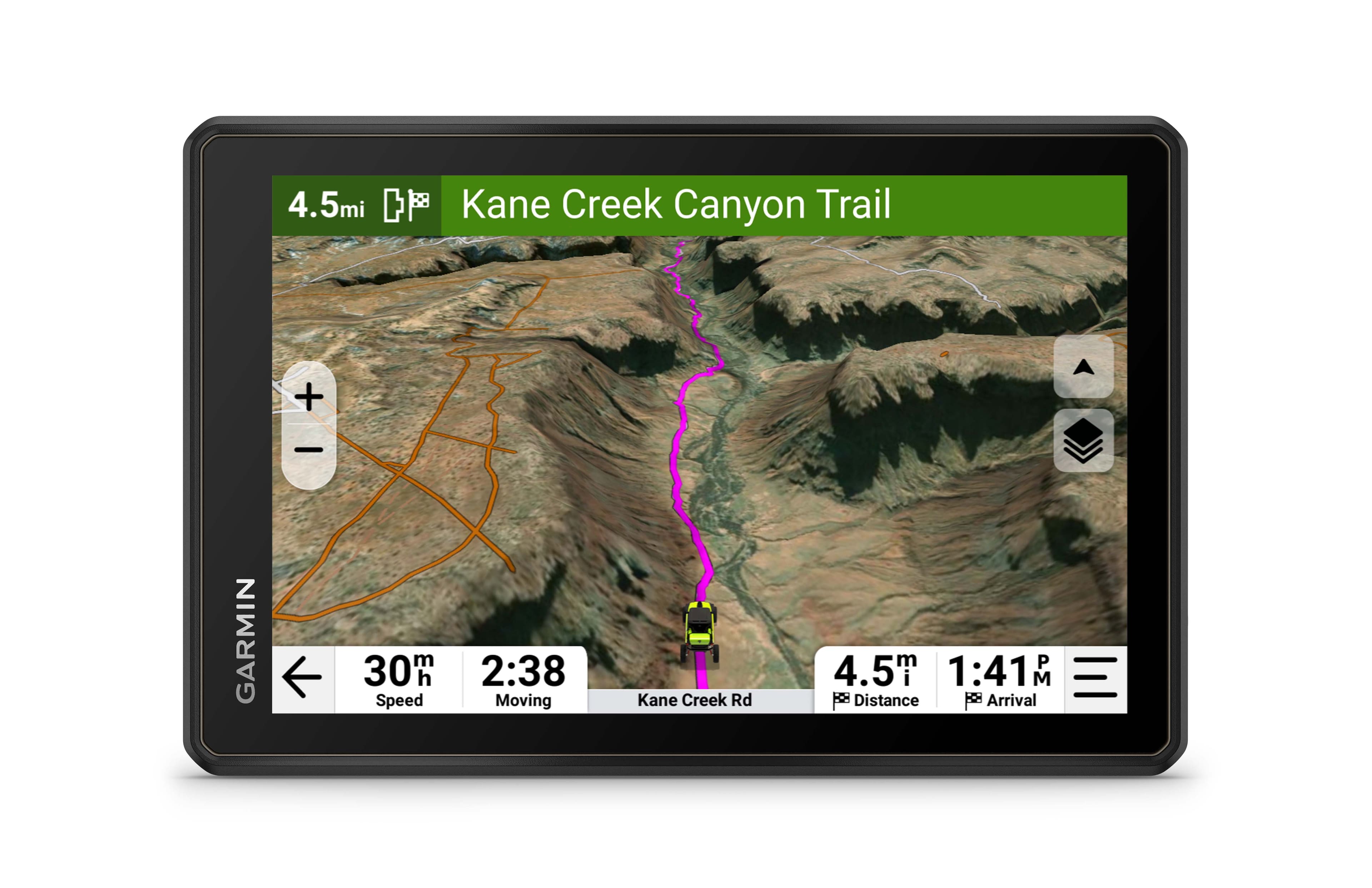
Garmin - Tread 2 - SxS Edition Powersport Navigator 8" GPS with Built-In Bluetooth - Black
SKU: JXF9YFFPJFSee all Portable GPSProduct Description
A rugged black GPS navigator with an 8" glove-friendly touchscreen, Bluetooth, topographic maps, and water resistance.Your price for this item is $899.99Save $100The previous price was $999.99 -
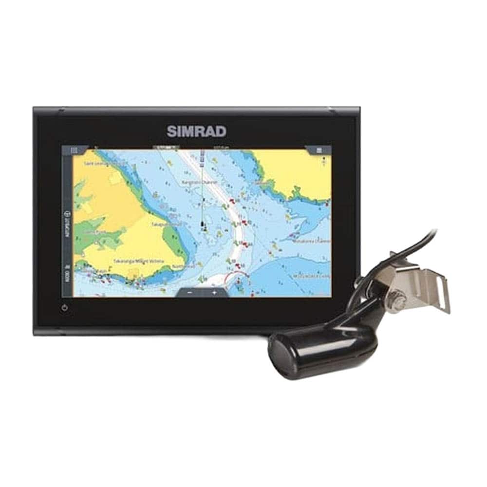
Simrad - GO9 XSE with HDI Transducer and C-MAP GPS DISCOVER Chart With Touchscreen - Black
SKU: BSWYRRXTCYSee all Portable GPSProduct Description
A black touchscreen marine GPS with HDI transducer, C-MAP charts, sonar, radar, and wireless connectivity.Your price for this item is $799.00 -
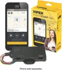
Viper - SmartStart Pro 2-Way, 4G Smartphone Compatible, GPS Module - Black
SKU: J7Q8KPXHPQSee all Remote Start & Security SystemsProduct Description
A black GPS module enabling 2-way remote start, keyless entry, and car tracking via smartphone app.Your price for this item is $179.99Save $40The previous price was $219.99 -
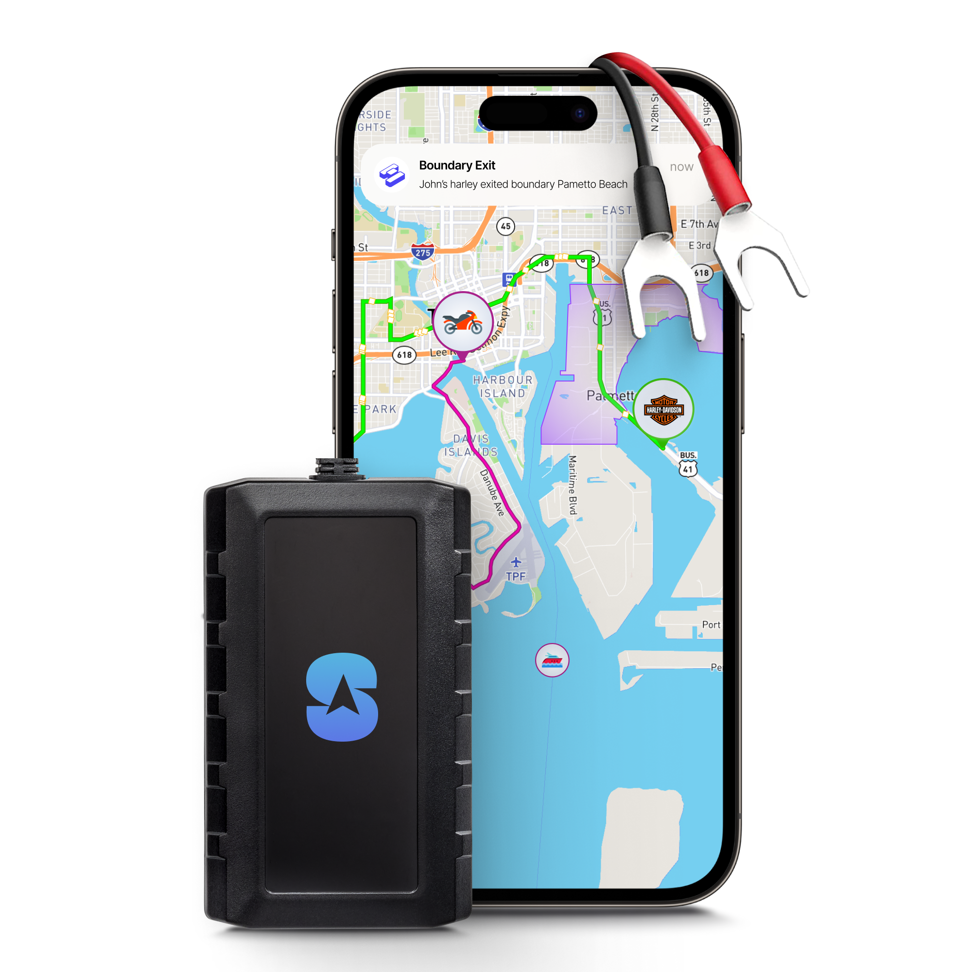
Spytec GPS - Moto GPS Tracker Real-Time Tracking for Motorcycles, Mopeds, Scooters, Boats ATVs - Anti Theft Movement Alert - Black
SKU: J3R8T6Q7RTSee all Bluetooth Trackers & AccessoriesProduct Description
A hardwired black GPS tracker providing real-time, maintenance-free vehicle tracking with instant movement alerts.Your price for this item is $29.95

Best Sellers
Related Pages


FAQ
When choosing a GPS device for driving, consider features such as real-time traffic updates, voice-guided navigation, large and clear display, map updates, points of interest, and Bluetooth connectivity for hands-free calling.
Yes, many GPS devices are designed specifically for outdoor activities like hiking, geocaching, and camping. Look for rugged, waterproof models with topographic maps and long battery life for the best outdoor experience.
Most standalone GPS devices use satellite signals and do not require an internet connection for navigation. However, some advanced features, such as real-time traffic updates or map downloads, may require a connection.
Many GPS devices offer map updates to ensure you have the latest road information. Some models include lifetime map updates, while others may require a subscription or one-time purchase for updates.
Built-in car GPS systems are integrated into the vehicle's dashboard, offering seamless operation and a sleek look. Portable GPS units are standalone devices that can be moved between vehicles and often provide more flexibility and frequent updates.