“Can I create my own maps? I am looking for a GPS system that I can locate trees (with longitude and latitude) and create my own map and export it as a gpx file or a file i can convert to a gpx file to upload on GIS. Also I am looking for the simplest version of this. something not expensive in the 150-200 dollar range. There is a product called a trimble that does it but it is wayyyyy to expensive. But I am looking for something like that.”
Answer This Question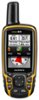
1-1 of 1 Answer
Your GPSMAP 64 does support custom maps. You would use an image overlay to create your custom map which would be a JPEG file. Additional information on creating a custom map can be found at this FAQ link: http://support.garmin.com/support/searchSupport/simpleCase.htm?caseId={2183bd60-bf34-11de-c454-000000000000}&kbName=garmin Here are some additional guidelines http://support.garmin.com/support/searchSupport/simpleCase.htm?caseId={9eb27dc0-6377-11df-f5aa-000000000000}&kbName=garmin for creating a custom map. Garmin consumer electronics has accuracy to less than 3 meters (10 feet) on average. As a consumer device, they do not offer survey grade accuracy. Your device also supports BirdsEye Satellite Imagery; a high-resolution satellite imagery that will allow you to view your surrounding area on your GPS and computer.
Sorry, there was a problem. Please try again later.