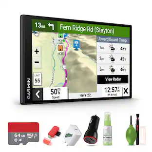
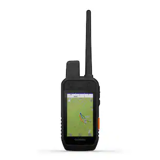
Garmin - Zumo XT2 6" GPS with Built-In Bluetooth and Map Updates - Black
Customers are saying
Customers have good things to say about this product, particularly highlighting its improved screen visibility and reliable overall performance. Users also frequently praise the device for its excellent GPS navigation capabilities and intuitive ease of use. Overall, the unit is highly regarded for its functionality and consistent performance.
Features
Ultrabright display
The 6” display is 15% larger than previous models and features an even brighter HD resolution in landscape or portrait mode.
Designed to endure
Rain? Vibration? Dust? Doesn’t matter. This device is built to withstand all kinds of weather (IPX7) and rough terrain.
Visual route planner
Plan a custom route on the device, or use the Tread app with a compatible Internet-enabled smartphone.
Simple map switching
Quickly toggle between on-road maps, topographic maps and satellite imagery, so you can always have the perfect map for your ride
Group tracking
Use the Tread app on your smartphone and/or zūmo XT2 device to track friends with the Group Ride Mobile feature. Or, use the Group Ride Radio accessory (sold separately) for tracking other zūmo XT2-equipped riders with no cellular coverage needed.
Satellite imagery
Use satellite imagery from around the world to help you navigate. Download the maps directly to your device via Wi-Fi technology. No annual subscription required.
Rider alerts
Get alerts for hazards along your route, such as upcoming sharp curves, speed changes and more. You’ll also be notified about state helmet laws and red light/speed cameras (additional fees may apply).
Music
Stream music from your Internet-enabled smartphone through the zūmo XT2 navigator, or play MP3 files stored on the navigator — all to your connected helmet or headset.
inReach compatibility
Pair zūmo XT2 with a compatible inReach satellite communicator for two-way messaging, location sharing and, in case of emergencies, SOS capabilities (additonal fees may apply).
Wireless updates
Built-in Wi-Fi connectivity makes it easy to keep your maps and software up to date without using a computer. On-screen cues show when new updates are available.
Live weather and traffic
Access real-time traffic and weather when connected to an Internet-enabled smartphone, share routes with other riders, and get phone notifications via the Tread app.
Bluetooth connectivity
Hear turn-by-turn directions or stream music from your compatible smartphone through a connected helmet or headset.
Incident notifications
If an incident occurs, a text message with location information is automatically sent to your predetermined contact.
Specifications
- Screen Size6 inchesTouch ScreenYes3D-Map ViewYesTopographic MapsYesProgrammable RoutesYesAlertsIncident detection, Incoming call, Incoming text, Photo radar, Railroad crossings, Red light camera, Rest areas, School zones, Speed camera
Reviews
Rating 4.4 out of 5 stars with 19 reviews
- Screen Visibility (9)
- GPS (4)
- Overall Performance (4)
- Ease of use (3)
Customer Images
The vast majority of our reviews come from verified purchases. Reviews from customers may include My Best Buy members, employees, and Tech Insider Network members (as tagged). Select reviewers may receive discounted products, promotional considerations or entries into drawings for honest, helpful reviews.
Compare similar products
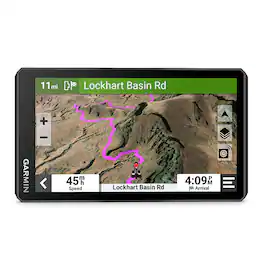
The zūmoXT2 rugged motorcycle navigator is built for adventure with a larger and brighter 6” sunlight-readable display that is built to withstand weather and handlebar vibrations. The new visual route planner lets you customize your journey with options such as choosing between a thrilling ride with extra twists and turns or experiencing a more efficient route. Start a group ride to track your friends on the zūmo display (requires the use of the Tread smartphone app). See popular moto paths and use satellite imagery to find new places to explore. Afterward, share your ride details, including elevation, acceleration and deceleration. For motorcyclists looking for the ultimate navigator, get ready to enjoy the ride.

The zūmo XT3 motorcycle navigator is designed for the open road or the closed track with a bright 6" display and rugged design built to withstand harsh weather, vibration and rough conditions. When it’s time to hit the road, use the visual route planner with preloaded street maps, and explore the great rides database to create a custom adventure; downloadable satellite imagery shows the view from above. After your ride, see how far you leaned over with the lean angle gauge. Ride the more curvy, scenic or thrilling roads with the Garmin Adventurous Routing setting, and see popular routes on your map with the popular moto paths feature. Headed to the track? With an active Garmin Performance Package plan, record drag race splits, lap times, session performance and more with the onboard sensors. Once the gear comes off, review and share your ride details — such as lean angle, G-force, speed, elevation and more — in the Tread smartphone app.

Simplify your drive with the Garmin DriveSmart 66 GPS navigator. Use Garmin voice assist to easily find and navigate where you want to go. The crisp 6” display and map updates of North America show you the way, providing alerts for speed changes and potential hazards ahead. Make the most of road trips with Tripadvisor traveler ratings, a directory of U.S. national parks and the HISTORY database of notable sites. Pair with the Garmin Drive app running on your compatible smartphone for on-screen access to live traffic, fuel prices, parking, weather and traffic cams to help avoid delays and keep you on your way. With Alexa Built-in (Drivers should focus on driving and only use this function when safe to do so. Must pair with the Garmin Drive app running on your compatible phone), you can ask to play music, listen to audiobooks, hear the news and more — all while you keep your hands on the wheel and eyes on the road. Not compatible with truck routes.

Roam the unknown with the rugged Tread 2 powersport navigator. The 6” high-resolution, ultrabright and glove-friendly touchscreen will show you the way in extreme terrain, temperatures and weather (IP67 water rating). Get turn-by-turn navigation for unpaved roads and trails for all the kinds of places you love to ride with OpenStreetMap, U.S. Forest Service Motor Vehicle Use Maps, Adventure Roads and Trails map content, and snowmobile-accessible trails and locations in the U.S. and Canada. Venture on- and off-road with high-definition digital elevation maps, private and public land boundaries, and City Navigator maps. Download subscription-free satellite imagery for high-resolution overhead views of routes and terrain (requires a connection with Wi-Fi technology). Support for Outdoor Maps+ (subscription required) allows you to download additional premium mapping such as slope angle, slope aspect, avalanche risk report and more. Track your friends’ locations with the Tread app via the group ride mobile feature when downloaded to your and each friend’s compatible smartphones (requires active cellular connections) enabled with Bluetooth technology. Or, pair Tread 2 with the 6” Group Ride Radio accessory for voice communication and tracking outside of a cellular network (sold separately; group tracking is available for riders using a compatible Garmin navigator and requires connection to vehicle power).
| Pros for Garmin - Zumo XT2 6" GPS with Built-In Bluetooth and Map Updates - Black | |||
|---|---|---|---|
| GPS, Overall Performance, Ease of use, Screen Visibility | There were no pros for this product— | Overall Performance, Ease of use, GPS, Screen Size, Navigation Accuracy | There were no pros for this product— |
| Cons for Garmin - Zumo XT2 6" GPS with Built-In Bluetooth and Map Updates - Black | |||
| There were no cons for this product— | There were no cons for this product— | Battery Life, Mounting, Connectivity, Volume | There were no cons for this product— |
Specs
Customers often buy these together
Garmin - Drive 53 5" GPS - Black
$99.99The price was $149.99
Garmin - DriveSmart 66 6" GPS with Built-In Bluetooth, Map Updates and Traffic Updates - Black
$199.99The price was $249.99



Customers ultimately bought

Explore related products Sponsored
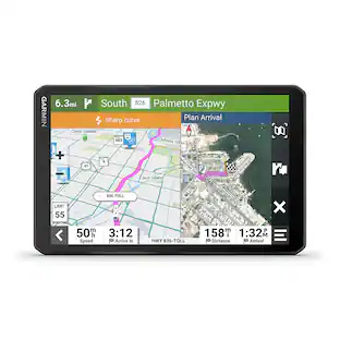
Garmin DriveCam 76 7" GPS Navigator with Built-In Camera and Built-In Bluetooth
$407.99The price was $449.99
Discover related products
MERACH Incline Treadmill with 7.5MPH, 2.5HP Brushless Double Deck Folding Treadmill LED Display with Smart APP
$269.99The price was $379.99MERACH Q1S Magnetic Rowing Machine, 16-Level Electromagnetic Resistance, Dual Slide Rail, App Connectivity
$199.99The price was $259.99Mikolo Smith Machine, 2200lbs Power Rack Cage with with Cable Crossover, Total Body Strength Training Cage
$759.99The price was $859.99Best Choice Products 40in Tabletop Foosball Table, Arcade Table Soccer for Home, Game Room w/ 2 Balls
$79.99The price was $89.99MERACH 4 in 1 Hand Weights Adjustable Dumbbell for Women at Home Exercise 8.8lb
$39.99The price was $59.99










Keep exploring
Garmin inReach Mini 3 Compact SOS Satellite Communicator with Accessories Package
$359.99The price was $484.92Garmin dezl OTR1020, Extra-Large, Easy-to-Read 10” GPS Truck Navigator Bundle
$917.99The price was $939.95