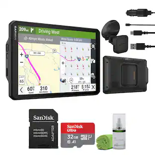
Garmin - Tread 2 Powersport Navigator 6" GPS with Built-In Bluetooth - Black
About this product
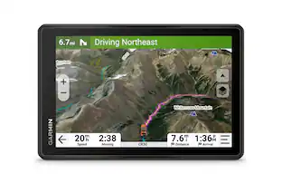
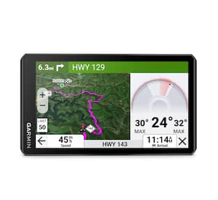
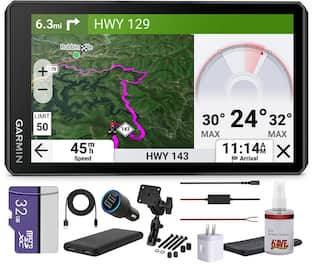
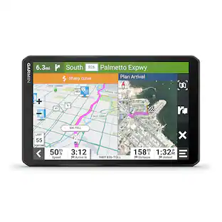
Roam the unknown with the rugged Tread 2 powersport navigator. The 6” high-resolution, ultrabright and glove-friendly touchscreen will show you the way in extreme terrain, temperatures and weather (IP67 water rating). Get turn-by-turn navigation for unpaved roads and trails for all the kinds of places you love to ride with OpenStreetMap, U.S. Forest Service Motor Vehicle Use Maps, Adventure Roads and Trails map content, and snowmobile-accessible trails and locations in the U.S. and Canada. Venture on- and off-road with high-definition digital elevation maps, private and public land boundaries, and City Navigator maps. Download subscription-free satellite imagery for high-resolution overhead views of routes and terrain (requires a connection with Wi-Fi technology). Support for Outdoor Maps+ (subscription required) allows you to download additional premium mapping such as slope angle, slope aspect, avalanche risk report and more. Track your friends’ locations with the Tread app via the group ride mobile feature when downloaded to your and each friend’s compatible smartphones (requires active cellular connections) enabled with Bluetooth technology. Or, pair Tread 2 with the 6” Group Ride Radio accessory for voice communication and tracking outside of a cellular network (sold separately; group tracking is available for riders using a compatible Garmin navigator and requires connection to vehicle power).
Features
Rugged Design
The 6” high-resolution, ultrabright and glove-friendly touchscreen navigator is purpose-built to withstand extreme temperatures and weather (IP67 dust/water rating) for rugged off-road adventures. The upgraded processor delivers faster performance, including map drawing and route calculations.
Turn-by-turn navigation
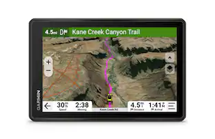
Get turn-by-turn trail navigation for unpaved roads and trails in off-road riding areas with OpenStreetMap, U.S. Forest Service Motor Vehicle Use Maps and Adventure Roads and Trails map content1. View areas included throughout North America.
Elevation maps and more
Venture off-road with high-definition digital elevation maps for dirt and snow trails, or follow City Navigator maps for street routes.
Satellite views
Download subscription-free satellite imagery directly to the device via Wi-Fi technology to see high-resolution overhead views of routes and terrain.
Snowmobile trails
View snowmobile trail content for select areas within the U.S. and Canadian provinces; includes snowmobile-accessible locations such as fuel stops, warming shelters, restaurants and more. View coverage areas in your state or province.
Outdoor maps
Purchase an Outdoor Maps+ subscription for ongoing access to premium map content, including slope angle, slope aspect, avalanche risk report and more. Learn more about the Outdoor Maps+ content available for Tread devices.
Specifications
- Screen Size6 inchesTouch ScreenYes3D-Map ViewYesTopographic MapsYesProgrammable RoutesYesAlertsIncoming call, Incoming text, Personalized locations, Rest areas, Traffic
Reviews
This product doesn't have any reviews yet.

Compare similar products

Roam the unknown with the rugged Tread 2 powersport navigator. The 6” high-resolution, ultrabright and glove-friendly touchscreen will show you the way in extreme terrain, temperatures and weather (IP67 water rating). Get turn-by-turn navigation for unpaved roads and trails for all the kinds of places you love to ride with OpenStreetMap, U.S. Forest Service Motor Vehicle Use Maps, Adventure Roads and Trails map content, and snowmobile-accessible trails and locations in the U.S. and Canada. Venture on- and off-road with high-definition digital elevation maps, private and public land boundaries, and City Navigator maps. Download subscription-free satellite imagery for high-resolution overhead views of routes and terrain (requires a connection with Wi-Fi technology). Support for Outdoor Maps+ (subscription required) allows you to download additional premium mapping such as slope angle, slope aspect, avalanche risk report and more. Track your friends’ locations with the Tread app via the group ride mobile feature when downloaded to your and each friend’s compatible smartphones (requires active cellular connections) enabled with Bluetooth technology. Or, pair Tread 2 with the 6” Group Ride Radio accessory for voice communication and tracking outside of a cellular network (sold separately; group tracking is available for riders using a compatible Garmin navigator and requires connection to vehicle power).
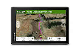
Roam the unknown with the rugged Tread 2 – SxS Edition powersport navigator. The 8” high-resolution, ultrabright and glove-friendly touchscreen will show you the way in extreme terrain, temperatures and weather (IP67 dust/water rating). Get turn-by-turn navigation for unpaved roads and trails for the kinds of places you love to ride. Venture on- and off-road with high-definition digital elevation maps, private and public land boundaries, and more. Find new places to explore with the great rides feature for off-road (searches require use of the Tread smartphone app). Download satellite imagery for high-resolution overhead views of routes and terrain (requires a connection with Wi-Fi technology). Support for Outdoor Maps+ (subscription required) allows ongoing access to additional premium map content, including burn zones, night lights and more. Track your friends’ locations with the Tread app via the group ride mobile feature when downloaded to your and each friend’s compatible smartphones enabled with BLUETOOTH technology (requires active cellular connections). Or, pair Tread 2 with the Group Ride Radio accessory for voice communication and tracking outside of a cellular network (sold separately; group tracking is available for riders using a compatible Garmin navigator and requires connection to vehicle power).
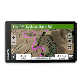
The zūmoXT2 rugged motorcycle navigator is built for adventure with a larger and brighter 6” sunlight-readable display that is built to withstand weather and handlebar vibrations. The new visual route planner lets you customize your journey with options such as choosing between a thrilling ride with extra twists and turns or experiencing a more efficient route. Start a group ride to track your friends on the zūmo display (requires the use of the Tread smartphone app). See popular moto paths and use satellite imagery to find new places to explore. Afterward, share your ride details, including elevation, acceleration and deceleration. For motorcyclists looking for the ultimate navigator, get ready to enjoy the ride.

Roam the unknown with the rugged Tread 2 – Overland Edition all-terrain navigator for true expeditioners. The 8” high-resolution, ultrabright and glove-friendly touchscreen will show you the way. Get turn-by-turn navigation for unpaved roads and trails for the kinds of places you love to travel. Venture on- and off-road with high-definition digital elevation maps, private and public land boundaries, and City Navigator maps. View preloaded topographic maps with 3D terrain for North and South America in addition to custom street routing in North America, based on the size and weight of your rig (not available in all areas; always defer to posted road signs and road conditions). Download subscription-free satellite imagery for high-resolution overhead views of routes and terrain (requires a connection with Wi-Fi technology). Use the preloaded directory of Ultimate Public Campgrounds to find good overnight stops along your route. Support for Outdoor Maps+ (subscription required) allows ongoing access to additional premium map content including burn zones, night lights and more. Plan trips easily with the Tread app on your compatible smartphone. And pair with a Garmin PowerSwitch digital switch box (sold separately) for convenient control of your vehicle’s 12-volt electronics — including light bars, differential locks and more — right from your Tread 2 touchscreen.
| Pros for Garmin - Tread 2 Powersport Navigator 6" GPS with Built-In Bluetooth - Black | |||
|---|---|---|---|
| There were no pros for this product— | There were no pros for this product— | Screen Size, GPS, Overall Performance, Ease of use | There were no pros for this product— |
Specs
Customers often buy these together
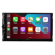
Jensen - CAR723W 7" Multimedia w/ Wireless Android Auto & Apple Carplay
$259.99The price was $279.99



More to consider
Enjoy your ride Sponsored
Discover related products


Keep exploring
 $459.99The price was $484.92
 $1,039.95The price was $1,059.95