Garmin - GPSMAP H1i Plus 3.5" GPS Outdoor Navigator with Maps for North America, inReach® Plus Technology and Built-in Bluetooth - Black
About this product
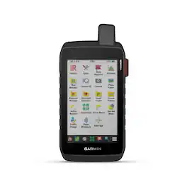
When adventure calls, respond. GPSMAP H1i Plus is the rugged GPS handheld navigator with built-in inReach Plus technology that’s ready for the wild (active satellite subscription required; some jurisdictions regulate or prohibit the use of satellite communication devices). Its hybrid design boasts a bright 3.5" color touchscreen display, physical buttons for versatility and a long battery life of up to 145 hours in GPS mode. You can stay in touch with loved ones when you venture beyond cell service by exchanging texts or using the built-in camera/mic to snap and share photos and voice messages. You can also trigger an SOS message to the 24/7-staffed Garmin Response international coordination center for assistance in an emergency. Navigate with preloaded TopoActive maps, downloadable satellite imagery and the option to purchase an Outdoor Maps+ subscription for ongoing access to premium map content. Multi-band GPS and multi-GNSS support gives you optimal positional accuracy for precise knowledge of where your adventure takes you.
Touchscreen display
The bright, sunlight-readable 3.5-inch color touchscreen has chemically strengthened glass to resist scratches. It is glove-friendly, easy to see and easy to use. Tap, zoom and swipe on the maps to follow your route.
Physical buttons
The rugged hybrid design also features intuitive push buttons for more versatility when operating in weather and while wearing gloves. The quick-action button lets users customize functions to their specific needs.
Photos and voice text messaging
With an active inReach subscription1, send group text messages up to 1,600 characters. You can also exchange photos and voice messages when outside of cellular coverage.
SOS alerts
Trigger an interactive SOS message anytime to the 24/7-staffed Garmin Response international coordination center for help in an emergency. This requires an active inReach subscription1.
Advanced navigation
Navigate with preloaded TopoActive maps for the U.S., Mexico and Canada — and easy-to-access global maps. See terrain contours, elevations, geographical points and more.
Satellite imagery
Download high-resolution photorealistic maps directly to your device via Wi-Fi technology. Find trails, pick stand locations and parking, create waypoints and more.
- Screen Size3.5 inchesTouch ScreenYes3D-Map ViewNoTopographic MapsYesPoints Of Interest15000Programmable RoutesYes
Reviews
This product doesn't have any reviews yet.
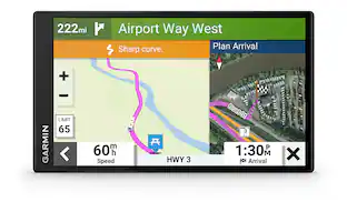
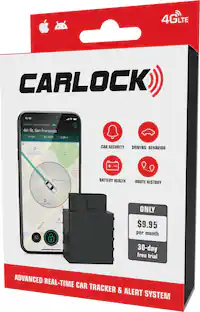
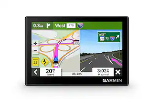
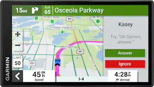
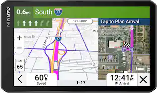
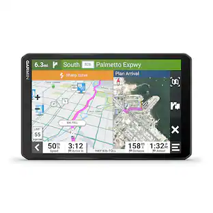
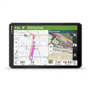
Compare similar products

When adventure calls, respond. GPSMAP H1i Plus is the rugged GPS handheld navigator with built-in inReach Plus technology that’s ready for the wild (active satellite subscription required; some jurisdictions regulate or prohibit the use of satellite communication devices). Its hybrid design boasts a bright 3.5" color touchscreen display, physical buttons for versatility and a long battery life of up to 145 hours in GPS mode. You can stay in touch with loved ones when you venture beyond cell service by exchanging texts or using the built-in camera/mic to snap and share photos and voice messages. You can also trigger an SOS message to the 24/7-staffed Garmin Response international coordination center for assistance in an emergency. Navigate with preloaded TopoActive maps, downloadable satellite imagery and the option to purchase an Outdoor Maps+ subscription for ongoing access to premium map content. Multi-band GPS and multi-GNSS support gives you optimal positional accuracy for precise knowledge of where your adventure takes you.
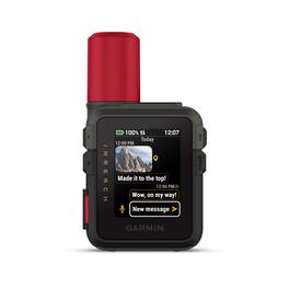
Stay connected off the grid with inReach Mini 3 Plus, the lightweight SOS satellite communicator with a color touchscreen display. Keep in touch beyond cell service, and exchange texts, voice messages and more on the device with an active satellite subscription (some jurisdictions regulate or prohibit the use of satellite communication devices). Send photos, group messages, or use LiveTrack location sharing to let friends and family follow your trip progress while you’re on the move; requires use of the Garmin Messenger smartphone app. Explore with peace of mind knowing you can trigger an interactive SOS message to Garmin Response — a 24/7-staffed international emergency coordination center. The rechargeable battery supports up to 350 hours with 10-minute inReach tracking.
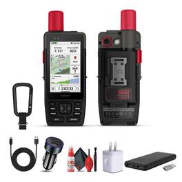
The GPSMAP H1i Plus Premium GPS Handheld with inReach Plus satellite technology is built for adventurers who need accurate navigation and reliable communication far beyond cellular coverage. Its hybrid design combines a glove-friendly 3.5-inch color touchscreen with rugged physical buttons, offering both intuitive map interaction and dependable operation in harsh conditions. The scratch-resistant glass and MIL-STD 810-tested build ensure durability against water, shock, and extreme environments. With an active inReach subscription, you can exchange text, photo, and voice messages, share location updates, and trigger interactive SOS alerts to the Garmin Response center for emergency support. LiveTrack functionality keeps family and teammates connected, while weather forecasts via Wi-Fi, cellular, or satellite help you prepare for changing conditions. Preloaded TopoActive maps, downloadable satellite imagery, and Outdoor Maps+ content provide detailed geographic data, while multi-band GPS and GNSS support deliver precise positioning in dense forests, mountains, or canyons. Built-in altimeter, barometer, and compass sensors enhance situational awareness, and ascent planning features help anticipate challenging climbs. A built-in LED flashlight and loud emergency siren add extra layers of safety, while the integrated cameras allow trip documentation and real-time sharing with inReach service. Long-lasting battery performance supports up to 145 hours in GPS mode and 840 hours in Expedition mode, making it reliable for extended treks. Compact and adaptable with Spine Mount 2 accessories, the GPSMAP H1i Plus is an essential tool for hikers, hunters, mountaineers, and explorers who demand resilience and connectivity in locations. Bundle Includes: Garmin GPSMAP H1i Plus, Premium GPS Handheld Navigator with inReach Plus Technology to Share Texts, Photos, Voice Memos USB3
Stay on track and in touch with the rugged Montana 760i handheld GPS navigator with inReach technology. Built to guide you through all kinds of adventures, it includes TopoActive mapping and a glove-friendly 5” color touchscreen. When you go beyond the limits of cell service, stay connected with inReach technology for two-way messaging, live tracking and interactive SOS alerts to the Garmin Response team, a 24/7-staffed international emergency response coordination center (active subscription required; some jurisdictions regulate or prohibit the use of satellite communication devices). Capture and tag the location of your photos along the way with the built-in camera. Expanded 32 GB memory capacity lets you store more maps to keep your expeditions on course. High-resolution satellite imagery, available via subscription-free, direct-to-device downloads (requires a connection with Wi-Fi technology), shows a clear overhead view of your route and surrounding terrain. Get the on- or off-road capabilities you need with multi-GNSS support and ABC sensors. Add ongoing access to Outdoor Maps+ (sold separately) for a wide variety of premium mapping content. Explore longer with up to 24 hours of battery life in GPS mode and up to 432 hours in ultralow-powered expedition mode, and recharge easily with a standard USB-C cable. Plus, Montana 760i meets MIL-STD 810 for thermal, shock and vibration and is rated IPX7 for water-resistance.
Specs
Enjoy your ride Sponsored
 $312.99The price was $349.99