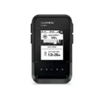
Garmin - eTrex 22x 2.2" GPS - Black
More Buying Options
Related Item

Specifications
- Screen Size2.2 inchesTouch ScreenYes3D-Map ViewYesLifetime Map UpdatesYesTopographic MapsYesProgrammable RoutesYes
- Key Specs
- Screen Size: 2.2 inches (Size of the screen, measured diagonally from corner to corner.)
- Touch Screen: true (Touch-screen devices make navigating more intuitive. Using a touch-screen display, you can do things such as tap to select, hold and drag to move items, swipe to scroll, and pinch to zoom.)
- 3D-Map View: true
- Lifetime Map Updates: true
- Topographic Maps: true
- Programmable Routes: true
- Integrated Camera: false
- App Compatible: true (The product can be connected to a program or software application on a mobile device, which then receives collected data from the product.)
- General
- Brand: Garmin
- Model Number: 010-02256-00
- Product Name: eTrex 22x 2.2" GPS
- Color: Black
- Designed Usage: Hiking, Geocaching, Outside
- Case Included: false
- Display
- Screen Size: 2.2 inches (Size of the screen, measured diagonally from corner to corner.)
- Touch Screen: true (Touch-screen devices make navigating more intuitive. Using a touch-screen display, you can do things such as tap to select, hold and drag to move items, swipe to scroll, and pinch to zoom.)
- Color Display: true
- 3D-Map View: true
- Resolution: 320 x 240 (Refers to the number of pixels, both horizontally and vertically, used to capture video/images. The higher the resolution the finer the detail that can be seen.)
- Backlit Display: true (Integrated lights allow for visibility of the display in low-light conditions.)
- Display Type: TFT
- Map
- Lifetime Map Updates: true
- Integrated Base Maps: true
- Map Coverage Area: U.S.
- Map Provider: Other
- Number Of Waypoints: 2000
- Geocaching Mode: true
- Topographic Maps: true
- Uploadable Maps: true
- Navigation
- Programmable Routes: true
- Emergency Services Locator: false
- Electronic Compass: true
- Environmental
- Water Resistant: true (Resists some degree of water penetration.)
- Maximum Depth Of Water Resistance: 3.2 feet (Measurement of the maximum depth of water in which the product is able to resist some degree of water penetration.)
- Barometric Altimeter: true
- Sun/Moon Information: true
- Hunt/Fish Calendar: true
- Temperature Display: true
- Features
- Location Reporting: true
- Integrated Camera: false
- Pedestrian Mode: true
- Storage
- Expandable Storage: true
- Memory Card Slot: true
- Memory Card Included: false (Indicates whether a memory card is included.)
- Compatibility
- App Compatible: true (The product can be connected to a program or software application on a mobile device, which then receives collected data from the product.)
- Connectivity
- Bluetooth Enabled: false (The device is capable of communicating with another device via Bluetooth, provided they are within the required range of each other. A Bluetooth-enabled device must also be the same Bluetooth version or higher than the accessory it is intended to pair with.)
- Number Of USB Port(s): 1 (The total number of USB ports including all generations and versions.)
- Dimensions
- Product Height: 4 inches (The out of box height of the item. Height is measured as the vertical distance from the bottom of the item to the top as it would be primarily used or placed.)
- Product Width: 2.1 inches (The out of box width of the item. Width is measured as the horizontal distance from one side of the item to the other as it would be primarily used or placed.)
- Product Depth: 1.3 inches (The out of box depth of the item. Depth is measured as the distance from the front of the item to the back as it would be primarily used or placed.)
- Product Weight: 0.5 pounds (The out of box weight of the item.)
- Power
- Rechargeable Battery: false
- Battery Size: AA (The battery size required for operation.)
- Batteries Included: false (Indicates whether the product comes with the required batteries for its operation.)
- Number of Batteries Required: 2
- Mounting
- Mount Included: false
- Warranty
- Warranty - Parts: 1 year limited
- Warranty - Labor: 1 year limited
- Other
- UPC: 753759230760
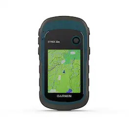
Explore with confidence with eTrex 22x, a rugged GPS handheld with a 2.2” sunlight-readable color display. It comes preloaded with TopoActive mapping featuring routable roads and trails to explore when cycling and hiking. Add even more maps via the microSD card slot and 8 GB of internal memory. With dual-satellite support (GPS and GLONASS), it tracks in more challenging environments than GPS alone.
- Explore: The eTrex 22x and 32x handheld devices come preloaded with road-routable TopoActive maps that feature streets and trails so you can take the journey off the grid.
- Connect via mini USB: Easily connect to your computer to get map updates and more
- Color Display: eTrex 22x and 32x offer enhanced 2.2”, 65K color, sunlight-readable displays. Durable and water resistant, these handhelds are built to withstand the elements.
- Keep Your Fix: The eTrex series uses both GPS and GLONASS satellite systems so the receiver has the ability to track in more challenging environments than GPS alone. eTrex 32x adds a 3-axis compass and barometric altimeter, making it easy for you to keep your bearings.
- Find Fun: eTrex 22x and eTrex 32x support paperless geocaching. Upload GPX files straight to your device, and view key information such as location, terrain and hints from Geocaching.com
- Disclaimer: Traffic content not available for all areas. See www.navteq.com/rdstraffic for traffic coverage areas
- Disclaimer: Updates require the internet and mini USB connection
- Disclaimer: Additional fees may apply.
Whats Included
- eTrex 22x
- USB cable
- Documentation
- eTrex 22x
- USB cable
- Documentation
- eTrex 22x
- USB cable
- Documentation
A: Yes, when using a distance data field the eTrex 22x will provide 2 places after the decimal point. Thank you for your review and experience with the xx. We would like to discuss this further over email. If you would please email us at [email protected]. Garmin
Q: is the garmin etrex voice activated and is the battery rechargeable??
A: The eTrex 22x is not voice activated and does recharging capabilities. For more information contact us at [email protected] or visit our Support Center, https://support.garmin.com/en-US/. Thanks Jenny
A: Yes, the eTrex 10 is easy to use and ready to go. For more information contact us at [email protected] or visit our Support Center, https://support.garmin.com/en-US/. Thanks Jenny
Q: What is the largest capacity micro sd card that can be used by this eTrex 22x?
A: The eTrex 22x can use a 32GB Class 10 SD Card. For more information contact us at [email protected] or visit our Support Center, https://support.garmin.com/en-US/. Thanks Jenny
Q: Will this gps work in an airplane while flying?
A: undefined
A: Today's GPS receivers are extremely accurate, thanks to their parallel multi-channel design. Certain atmospheric factors and other sources (tall buildings, densely populated areas, etc.) of error can affect the accuracy of GPS receivers. Garmin® GPS receivers are accurate to within 15 meters (49 feet) 95% of the time. Generally, users will see accuracy within 5 to 10 meters (16 to 33 feet) under normal conditions. For more information please view our Support Center, https://support.garmin.com/en-US/. You can also contact Product Support or email us at [email protected]. Thanks Garmin
A: The eTrex 22X has the TracBack® feature allows you to navigate back along your previously recorded track. Most newer Garmin outdoor handhelds are designed to start tracking once satellite connection is acquired. Due to this, it is best to reset the track and trip data at your starting point so your device knows the path you should follow back with TracBack navigation. This also helps eliminate straight lines from your last known location to your current location (ie. from your home to the current trailhead). Garmin
Q: Will this show a straight line between two points?
A: undefined
Compare similar products
Explore with confidence with eTrex 22x, a rugged GPS handheld with a 2.2” sunlight-readable color display. It comes preloaded with TopoActive mapping featuring routable roads and trails to explore when cycling and hiking. Add even more maps via the microSD card slot and 8 GB of internal memory. With dual-satellite support (GPS and GLONASS), it tracks in more challenging environments than GPS alone.

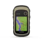
Explore with confidence with eTrex 32x, a rugged GPS handheld with preloaded maps and a 2.2” sunlight-readable color display. It comes with TopoActive mapping featuring routable roads and trails to explore when hiking or cycling. Add even more maps via the microSD card slot and 8 GB of internal memory. With dual-satellite support (GPS and GLONASS) and a 3-axis compass and barometric altimeter, it tracks in more challenging environments than GPS alone.
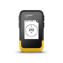
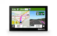
Ready. Set. Hike. With the eTrex SE GPS handheld navigator, you’ll get battery life that lasts up to 168 hours with 2 AA batteries (not included). You’ll view waypoints, track your location and find your way back to favorite spots on the 2.2” high-resolution screen. You can pair it with the Garmin Explore app on your compatible smartphone for wireless software updates, Geocaching Live, wireless connectivity for cloud storage, Active Weather, smart notifications and more. It’s water-resistant (rated to IPX7) and offers multi-GNSS support to track in more challenging environments than GPS alone. With a digital compass that’s accurate even while standing still, it provides what you need to enjoy the outdoors more.

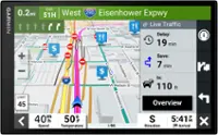
Montana 750i is the ruggedly versatile GPS navigator and satellite communicator that keeps you in touch and on track. It combines TopoActive and City Navigator mapping with global two-way messaging and interactive SOS via inReach satellite technology (active satellite subscription required; some jurisdictions regulate or prohibit the use of satellite communications devices) — plus a built-in 8-megapixel camera to capture your outdoor adventures. The 5” color touchscreen features a full QWERTY keyboard for messaging and a display that’s 50% larger than earlier models. It includes multi-GNSS support plus sensors for the 3-axis compass and barometric altimeter. Wireless pro-connectivity gives you direct-to-device access to BirdsEye Satellite Imagery downloads, location sharing, Connect IQ app support and more. Pair with a compatible smartphone to access Active Weather forecasts. Extend battery life for more than a week with the new ultralow-powered Expedition mode. For hunters and trainers, the IPX7-rated unit syncs with compatible Astro or Alpha series handhelds (sold separately) to help track sporting dogs in the field.
Specs
Reviews
Customer Images
The vast majority of our reviews come from verified purchases. Reviews from customers may include My Best Buy members, employees, and Tech Insider Network members (as tagged). Select reviewers may receive discounted products, promotional considerations or entries into drawings for honest, helpful reviews.
- Rated 5 out of 5 stars
Etrex 22x
Perfect for my needs. I did not require the extras on the 32x. Easy to use. Price point was very competitive. Delivery was prompt.
This review is from Garmin - eTrex 22x 2.2" GPS - Black
Hiker Posted
- Rated 5 out of 5 stars
e trex
used for hiking and mapping out the sites to visit.
This review is from Garmin - eTrex 22x 2.2" GPS - Black
jojo Posted
- Rated 4 out of 5 stars
Trails
Looking forward to learning more about this item and taking some nice trail walks
This review is from Garmin - eTrex 22x 2.2" GPS - Black
Robertm Posted