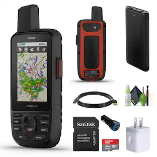
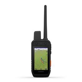
Garmin - Alpha 300i Handheld, Advanced Tracking and Training Handheld with inReach® Technology - Black
Reviews coming soon
More Buying Options from Marketplace sellers

Specifications
- Screen Size3.5 inches
- Key Specs
- Screen Size: 3.5 inches (Size of the screen, measured diagonally from corner to corner.)
- General
- Brand: Garmin
- Model Number: 010-02806-50
- Product Name: Garmin Alpha 300i Handheld, Advanced Tracking and Training Handheld with inReach® Technology
- Color: Black
- Designed Usage: Outside
- Display
- Screen Size: 3.5 inches (Size of the screen, measured diagonally from corner to corner.)
- Color Display: true
- Map
- Integrated Base Maps: true
- Environmental
- Water Resistant: false (Resists some degree of water penetration.)
- Features
- Pedestrian Mode: true
- Storage
- Built-in Storage: 16 gigabytes
- Connectivity
- Bluetooth Enabled: true (The device is capable of communicating with another device via Bluetooth, provided they are within the required range of each other. A Bluetooth-enabled device must also be the same Bluetooth version or higher than the accessory it is intended to pair with.)
- Dimensions
- Product Height: 6.000 inches (The out of box height of the item. Height is measured as the vertical distance from the bottom of the item to the top as it would be primarily used or placed.)
- Product Width: 8.000 inches (The out of box width of the item. Width is measured as the horizontal distance from one side of the item to the other as it would be primarily used or placed.)
- Product Depth: 10.000 inches (The out of box depth of the item. Depth is measured as the distance from the front of the item to the back as it would be primarily used or placed.)
- Product Weight: 1.4 pounds (The out of box weight of the item.)
- Warranty
- Warranty - Parts: 90 Days
- Warranty - Labor: 1 year
- Other
- UPC: 753759312329
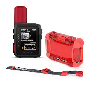
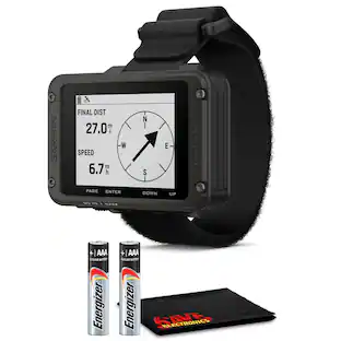
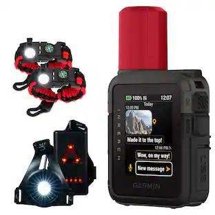
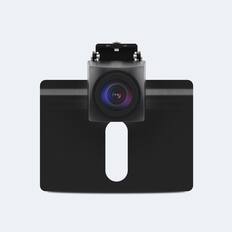
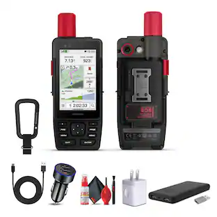
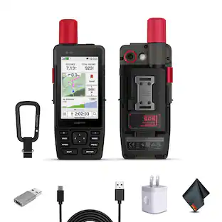
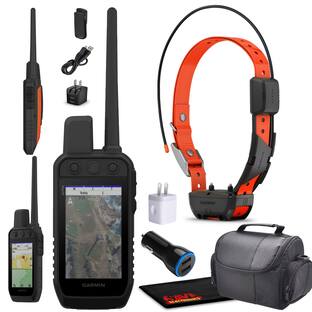
Lead your pack with the Alpha® 300i dog tracking and training handheld. It features inReach® satellite technology for two-way messaging and interactive SOS alerts (active subscription required; jurisdiction restrictions may apply). Track and train up to 20 dogs from up to 9 miles when paired with your compatible dog collars. See it all on a vivid 3.5” touchscreen display with up to a 2.5-second update rate. Easily control training functions using the button-operated design, which gives you 18 levels of stim, tone or vibration when paired to your training-enabled collar. Access premium Garmin navigation features, such as preloaded TopoActive maps, satellite imagery, and a built-in 3-axis compass and barometric altimeter. With up to 50 hours of battery life, you don’t have to worry about running out of power before your dogs do.
- Feature 1: Features a vivid sunlight-readable 3.5” capacitive touchscreen display and a button-operated, dog-focused design for quick, minor adjustments
- Feature 2: Easily set up and monitor up to 20 dogs with your compatible dog collars from up to 9 miles away (depending on your dog collar) with up to a 2.5-second update rate
- Feature 3: With an Outdoor Maps+ subscription, you have access to a wide variety of premium mapping content that is regularly updated and wirelessly delivered directly to your Alpha 300i handheld when connected to a wireless network
- Feature 4: Dog list and group management let you keep non-paired dog information in the handheld for easier setup
- Feature 5: Send interactive SOS alerts and two-way messaging via the 100% global Iridium satellite network with inReach satellite technology (active subscription required; some jurisdictions regulate or prohibit the use of satellite communication devices; it is the responsibility of the user to know and follow all applicable laws in the jurisdictions where the device is intended to be used
Whats Included
- Manufacturer Items
Disclaimers
- Product has features that may require an additional subscription. Additional fees may apply.
Compare similar products
Lead your pack with the Alpha® 300i dog tracking and training handheld. It features inReach® satellite technology for two-way messaging and interactive SOS alerts (active subscription required; jurisdiction restrictions may apply). Track and train up to 20 dogs from up to 9 miles when paired with your compatible dog collars. See it all on a vivid 3.5” touchscreen display with up to a 2.5-second update rate. Easily control training functions using the button-operated design, which gives you 18 levels of stim, tone or vibration when paired to your training-enabled collar. Access premium Garmin navigation features, such as preloaded TopoActive maps, satellite imagery, and a built-in 3-axis compass and barometric altimeter. With up to 50 hours of battery life, you don’t have to worry about running out of power before your dogs do.

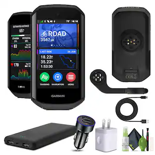
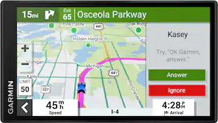
Introduce the rider you are today to the one you’ll be tomorrow. The Edge 540 cycling computer offers targeted adaptive coaching when used with your compatible power meter and heart rate monitor. It helps you manage your efforts by providing power targets throughout a course plus stamina insights, so you know how much gas is left in the tank. Get superior positional accuracy under dense tree cover or the urban canyon, thanks to multi-band GNSS technology. It features button controls that work in any conditions. Whether you’re riding roads, trails, gravel or indoor, you can benefit from insights and workouts that will help you understand your strengths and weaknesses and prepare for upcoming races or personal milestones.

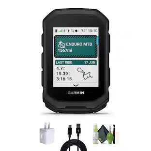
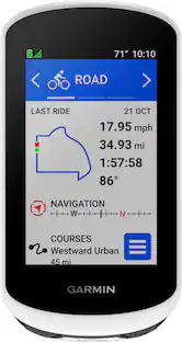
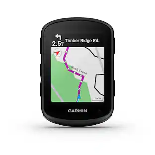
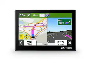
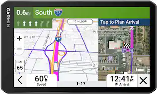
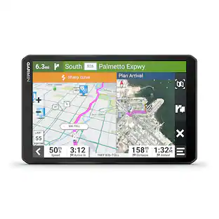
Discover new routes, and ride with confidence using the Edge Explore 2 GPS cycling computer. This navigator features a bright 3” touchscreen display, and it’s simple to set up and ready to ride straight out of the box. Ride like a local during your next on- or off-road adventure. High-contrast maps provide bike-specific, turn-by-turn navigation — and highlight popular roads and trails along with high-traffic areas. When connected to your compatible eBike, receive navigation guidance and alerts based on your bike’s battery status, assist level and range. Plus, safety features such as incident detection and Assistance let you ride with greater peace of mind (Requires setup and your smartphone to be in an area with network coverage).

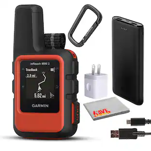
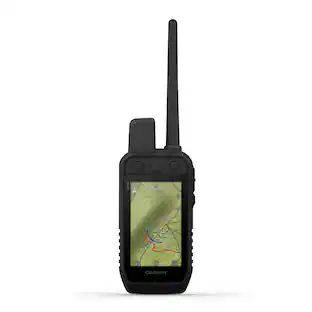
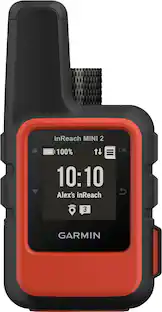
Home is closer than you think with inReach Mini 2. This compact satellite communicator adds peace of mind to your adventures without adding weight to your pack. (Some jurisdictions regulate or prohibit the use of satellite communication devices). Stay in touch globally with two-way communication and interactive SOS capabilities (active satellite subscription required). TracBack routing navigates you back to your starting point the same way you came — right on your device. You can also share your location with loved ones back home by using your MapShare page or with your coordinates embedded in your messages. The digital compass delivers accurate heading information, even when you’re not moving. Use the Garmin Explore app on a compatible smartphone to plan trips, access topographical maps, create waypoints and courses you can sync to your device, and more. Stay on adventures longer with up to 14 days of battery life in 10-minute tracking mode.
| Pros for Garmin - Alpha 300i Handheld, Advanced Tracking and Training Handheld with inReach® Technology - Black | |||
|---|---|---|---|
| There were no pros for this product— | Overall Performance | There were no pros for this product— | Overall Performance, GPS, Portability, Connectivity, Size |
Specs
Reviews
This product doesn't have any reviews yet.
Customers often buy these together
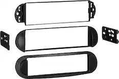
Metra - Dash Kit for Select 1998-2010 Volkswagen Beetle DIN - Black
$11.99The price was $17.99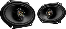
Kenwood - Road Series 6" x 8" 2-Way Car Speakers with Cloth Cones (Pair) - Black
Black Friday in July Deal$49.99The price was $79.99


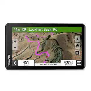
More to consider
 $312.99The price was $349.99
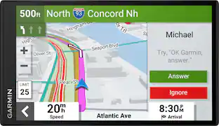 $290.99The price was $299.99

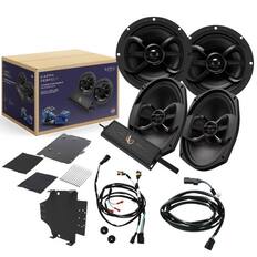
Enjoy your ride Sponsored
- $312.99The price was $349.99
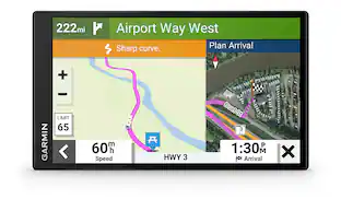
Keep exploring
 $634.95The price was $639.95
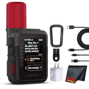 $509.99The price was $514.95