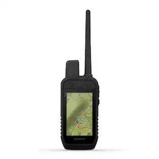
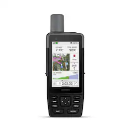
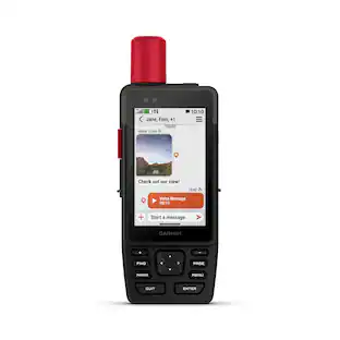
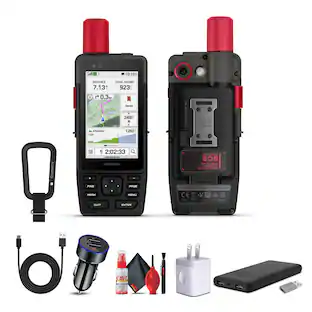
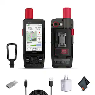
Garmin - GPSMAP H1 3.5" GPS Handheld Outdoor Navigator with Maps for North America and Built-in Bluetooth - Black
More Buying Options from Best Buy and Marketplace sellers
Related Item

Specifications
- Screen Size3.5 inchesTouch ScreenYes3D-Map ViewNoTopographic MapsYesPoints Of Interest15000Programmable RoutesYes
- Key Specs
- Screen Size: 3.5 inches (Size of the screen, measured diagonally from corner to corner.)
- Touch Screen: true (Touch-screen devices make navigating more intuitive. Using a touch-screen display, you can do things such as tap to select, hold and drag to move items, swipe to scroll, and pinch to zoom.)
- 3D-Map View: false
- Topographic Maps: true
- Points Of Interest: 15000
- Programmable Routes: true
- Alerts: Personalized locations
- App Compatible: true (The product can be connected to a program or software application on a mobile device, which then receives collected data from the product.)
- Wi-Fi Built-in: true (Able to connect directly to a wireless network without the use of an adapter.)
- General
- Brand: Garmin
- Model Number: 010-02920-00
- Product Name: GPSMAP H1 3.5" GPS Handheld Outdoor Navigator with Maps for North America and Built-in Bluetooth
- Color: Black
- Designed Usage: Hiking, Geocaching, Outdoor, Tracking
- Case Included: false
- Display
- Screen Size: 3.5 inches (Size of the screen, measured diagonally from corner to corner.)
- Touch Screen: true (Touch-screen devices make navigating more intuitive. Using a touch-screen display, you can do things such as tap to select, hold and drag to move items, swipe to scroll, and pinch to zoom.)
- Color Display: true
- 3D-Map View: false
- Backlit Display: true (Integrated lights allow for visibility of the display in low-light conditions.)
- Display Type: TFT
- Map
- Integrated Base Maps: true
- Map Coverage Area: North America, Worldwide
- Map Sharing: true
- Number Of Waypoints: 15000
- Geocaching Mode: true
- Topographic Maps: true
- Uploadable Maps: true
- Navigation
- Points Of Interest: 15000
- Programmable Routes: true
- Voice Prompts: true
- Emergency Services Locator: true
- Electronic Compass: true
- Environmental
- Water Resistant: true (Resists some degree of water penetration.)
- Maximum Depth Of Water Resistance: 3 feet (Measurement of the maximum depth of water in which the product is able to resist some degree of water penetration.)
- Barometric Altimeter: true
- Sun/Moon Information: true
- Temperature Display: true
- Features
- Location Reporting: true
- Alerts: Personalized locations
- Pedestrian Mode: true
- Text-To-Speech: false (A system that converts language text into speech.)
- Storage
- Built-in Storage: 64 gigabytes
- Expandable Storage: true
- Memory Card Slot: true
- Memory Card Included: false (Indicates whether a memory card is included.)
- Compatibility
- App Compatible: true (The product can be connected to a program or software application on a mobile device, which then receives collected data from the product.)
- Computer Compatibility: Android, Apple iOS
- Unit-To-Unit Transfer: true
- Automatic Sync: true
- Connectivity
- Bluetooth Enabled: true (The device is capable of communicating with another device via Bluetooth, provided they are within the required range of each other. A Bluetooth-enabled device must also be the same Bluetooth version or higher than the accessory it is intended to pair with.)
- Number Of USB Port(s): 1 (The total number of USB ports including all generations and versions.)
- Wi-Fi Built-in: true (Able to connect directly to a wireless network without the use of an adapter.)
- Dimensions
- Product Height: 7 inches (The out of box height of the item. Height is measured as the vertical distance from the bottom of the item to the top as it would be primarily used or placed.)
- Product Width: 2.6 inches (The out of box width of the item. Width is measured as the horizontal distance from one side of the item to the other as it would be primarily used or placed.)
- Product Depth: 1.3 inches (The out of box depth of the item. Depth is measured as the distance from the front of the item to the back as it would be primarily used or placed.)
- Product Weight: 0.61 pounds (The out of box weight of the item.)
- Power
- Rechargeable Battery: true
- Battery Life: 160 hours (Battery life will vary depending on the product configuration, product model, applications loaded on the product, power management setting of the product and the product features used by the customer. As with all batteries, the maximum capacity of this battery will decrease with time and usage.)
- Battery Chemistry: Lithium-ion
- Interface(s): USB-C (Refers to the types of connections that devices use to interact and communicate with each other.)
- Charging Method: USB
- Mounting
- Mount Included: false
- Warranty
- Warranty - Parts: 1 year limited
- Warranty - Labor: 1 year limited
- Other
- UPC: 753759329709
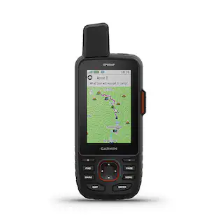
When adventure calls, respond. GPSMAP H1 is the rugged GPS handheld navigator that’s ready for the wild. Its hybrid design boasts a bright 3.5" color touchscreen display, physical buttons for versatility and a long battery life of up to 145 hours in GPS mode. Easily navigate rugged trails with a purpose-built design that can withstand harsh environments and weather. Navigate with preloaded TopoActive maps, downloadable satellite imagery and the option to purchase an Outdoor Maps+ subscription for ongoing access to premium map content. Multi-band GPS and multi-GNSS support gives you superior positional accuracy for precise knowledge of where any adventure takes you.
- Touchscreen display: The bright, sunlight-readable 3.5-inch color touchscreen has chemically strengthened glass to resist scratches. It is glove-friendly, easy to see and easy to use. Tap, zoom and swipe on the maps to follow your route.
- Physical buttons: The rugged hybrid design also features intuitive push buttons for more versatility when operating in weather and while wearing gloves. The quick-action button lets users customize functions to their specific needs.
- Advanced navigation: Navigate with preloaded TopoActive maps for the U.S., Mexico and Canada — and easy-to-access global maps. See terrain contours, elevations, geographical points and more.
- Satellite imagery: Download high-resolution photorealistic maps directly to your device via Wi-Fi technology. Find trails, pick stand locations and parking, create waypoints and more.
- Outdoor Maps+: Purchase an Outdoor Maps+ plan for access to a variety of premium mapping content across the globe. The subscription is updated regularly and sent to your device over Wi-Fi.
- Location accuracy: Get multi-band GPS and multi-GNSS support for superior positional accuracy.
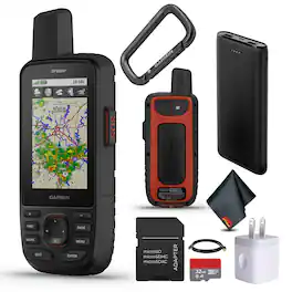
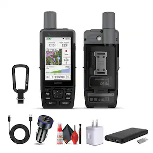
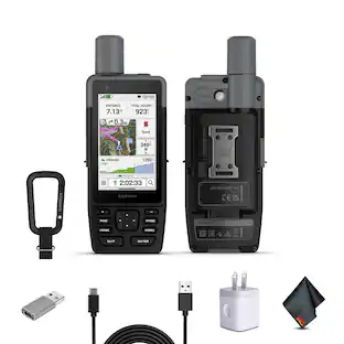
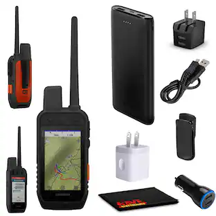
Whats Included
- GPSMAP H1
- Caribiner
- Cable
- Manual
Disclaimers
- Product has features that may require an additional subscription. Additional fees may apply.
Q: Can I upload my own maps to this GPS device?
A: Yes, you can upload maps to this GPS handheld device.
Q: Are personalized location alerts available on this GPS?
A: Yes, personalized location alerts are available on this GPS.
Q: Does this GPS navigator have a touch screen?
A: Yes, this GPS navigator has a touch screen.
Q: How many waypoints can this GPS device store?
A: This GPS device can store 15000 waypoints.
Q: What type of battery does the GPS unit use?
A: The GPS unit uses a lithium-ion battery.
Q: Does this GPS navigator have topographic maps?
A: Yes, this GPS navigator comes with topographic maps.
Q: Is this GPS handheld water resistant?
A: Yes, this GPS handheld is water resistant.
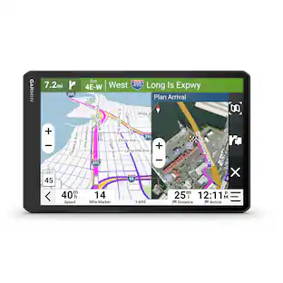
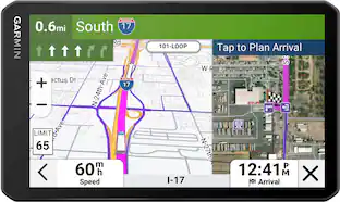
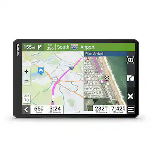
Compare similar products
When adventure calls, respond. GPSMAP H1 is the rugged GPS handheld navigator that’s ready for the wild. Its hybrid design boasts a bright 3.5" color touchscreen display, physical buttons for versatility and a long battery life of up to 145 hours in GPS mode. Easily navigate rugged trails with a purpose-built design that can withstand harsh environments and weather. Navigate with preloaded TopoActive maps, downloadable satellite imagery and the option to purchase an Outdoor Maps+ subscription for ongoing access to premium map content. Multi-band GPS and multi-GNSS support gives you superior positional accuracy for precise knowledge of where any adventure takes you.

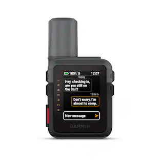
When adventure calls, respond. GPSMAP H1i Plus is the rugged GPS handheld navigator with built-in inReach Plus technology that’s ready for the wild (active satellite subscription required; some jurisdictions regulate or prohibit the use of satellite communication devices). Its hybrid design boasts a bright 3.5" color touchscreen display, physical buttons for versatility and a long battery life of up to 145 hours in GPS mode. You can stay in touch with loved ones when you venture beyond cell service by exchanging texts or using the built-in camera/mic to snap and share photos and voice messages. You can also trigger an SOS message to the 24/7-staffed Garmin Response international coordination center for assistance in an emergency. Navigate with preloaded TopoActive maps, downloadable satellite imagery and the option to purchase an Outdoor Maps+ subscription for ongoing access to premium map content. Multi-band GPS and multi-GNSS support gives you optimal positional accuracy for precise knowledge of where your adventure takes you.

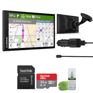
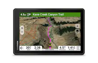
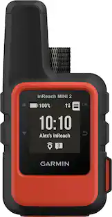
Go explore the outdoors — and stay connected to home — with the GPSMAP 67i handheld. Using inReach technology, this button-operated GPS handheld and satellite communicator enables two-way messaging and location tracking (active subscription required; some jurisdictions regulate or prohibit the use of satellite communications devices). You can also trigger an interactive SOS to Garmin Response, a 24/7 staffed emergency response coordination center. Navigate confidently with preloaded TopoActive mapping and satellite imagery. When paired with your compatible smartphone, you can access active weather forecasts and Geocaching Live. Use the Garmin Explore website or app on your compatible smartphone to help you plan trips and more, and download premium maps with an Outdoor Maps+ subscription. During extended activities, turn on expedition mode for up to 425 hours of battery life in 30-minute tracking mode.
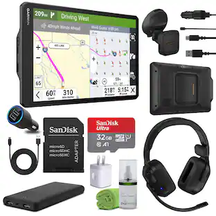
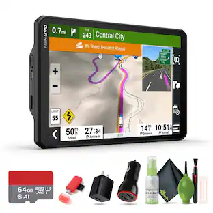
The Garmin GPSMAP 67i handheld and GPS satellite communicator is the ultimate companion for Hiking, Camping, and outdoor Adventures, offering unparalleled connectivity, navigation, and durability. With inReach satellite GPS Handheld communication, users can stay connected with two-way messaging, interactive SOS alerts & location sharing via the global Iridium network, ensuring safety and communication in locations. Featuring long battery life, multi-band GNSS support, and ABC sensors, this device provides accurate navigation data even in challenging conditions. Preloaded with detailed maps and offering premium map features with subscription. With the Garmin Messenger app and Garmin Explore app, seamless integration with smartphones enables messaging, group communication, and waypoint syncing. This handheld is built to military standards for thermal, shock and water performance (MIL-STD-810), and it's even compatible with night vision goggles. Use inReach connectivity to get detailed weather updates on the GPSMAP 67i handheld. Request weather forecasts for your current location, waypoints or destinations on your route. Access multiple global navigation satellite systems (GPS, Galileo and QZSS). Get access to multiple frequencies sent by navigation satellites for improved position accuracy in areas where GNSS signals are reflected, weak or typically don't penetrate. Built to military standards and equipped with a built-in LED flashlight, the Garmin inReach GPSMAP 67i Handheld GPS Satellite Communicator is rugged and reliable for any adventure, making it the ultimate tool for outdoor exploration and safety. Bundle Includes: Garmin GPSMAP 67i Rugged GPS Handheld with inReach Satellite Technology USB Charching Adapters Cube Microfiber Cleaning Cloth P-Bank Battery microSDHC Ultra 32GB Memory Card with Adapter
| Pros for Garmin - GPSMAP H1 3.5" GPS Handheld Outdoor Navigator with Maps for North America and Built-in Bluetooth - Black | |||
|---|---|---|---|
| There were no pros for this product— | There were no pros for this product— | Overall Performance | There were no pros for this product— |
Specs
Reviews
This product doesn't have any reviews yet.
Customers often buy these together
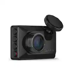
Garmin - Dash Cam X210 1440p Dash Cam with a 140-degree Field of View and built-in Clarity Polarizer - Black
$237.99The price was $299.99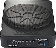
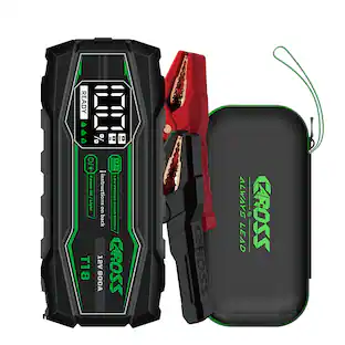
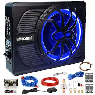
KICKER - Hideaway 10" Compact Powered Subwoofer - Black
Black Friday in July Deal$319.99The price was $399.99


More to consider

Enjoy your ride Sponsored
 Black Friday in July Deal$49.99The price was $74.99
 $312.99The price was $349.99
Discover related products
 Black Friday in July Deal$99.99The price was $209.99
 $77.99The price was $79.99


Keep exploring
 $159.99The price was $179.99
 $884.95The price was $894.95
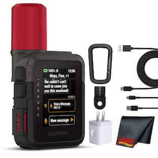 $509.99The price was $514.95