GPS With Satellite Imagery
-
Garmin - GPSMAP 67 3" GPS with Built-In Bluetooth - Black
SKU: JXF9YFZW5FSee all Portable GPSProduct Description
A rugged black handheld GPS with multi-band GNSS, Bluetooth, color display, and advanced mapping features.Your price for this item is $499.99 -
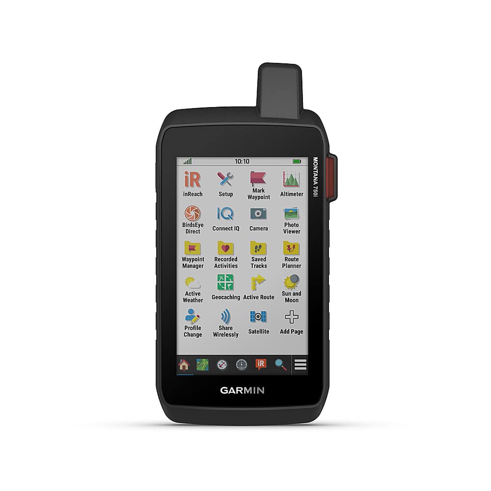
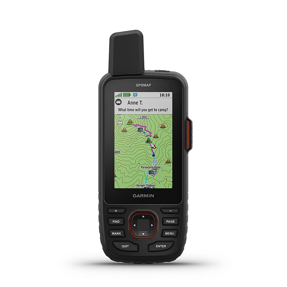
Garmin - Montana 750i 5" GPS with Built-in Bluetooth - Black
SKU: JXF9YFHKK3See all Portable GPSProduct Description
A rugged black GPS navigator with touchscreen, satellite messaging, built-in camera, and multi-GNSS support for outdoor adventures.Your price for this item is $649.99Save $150The previous price was $799.99 -
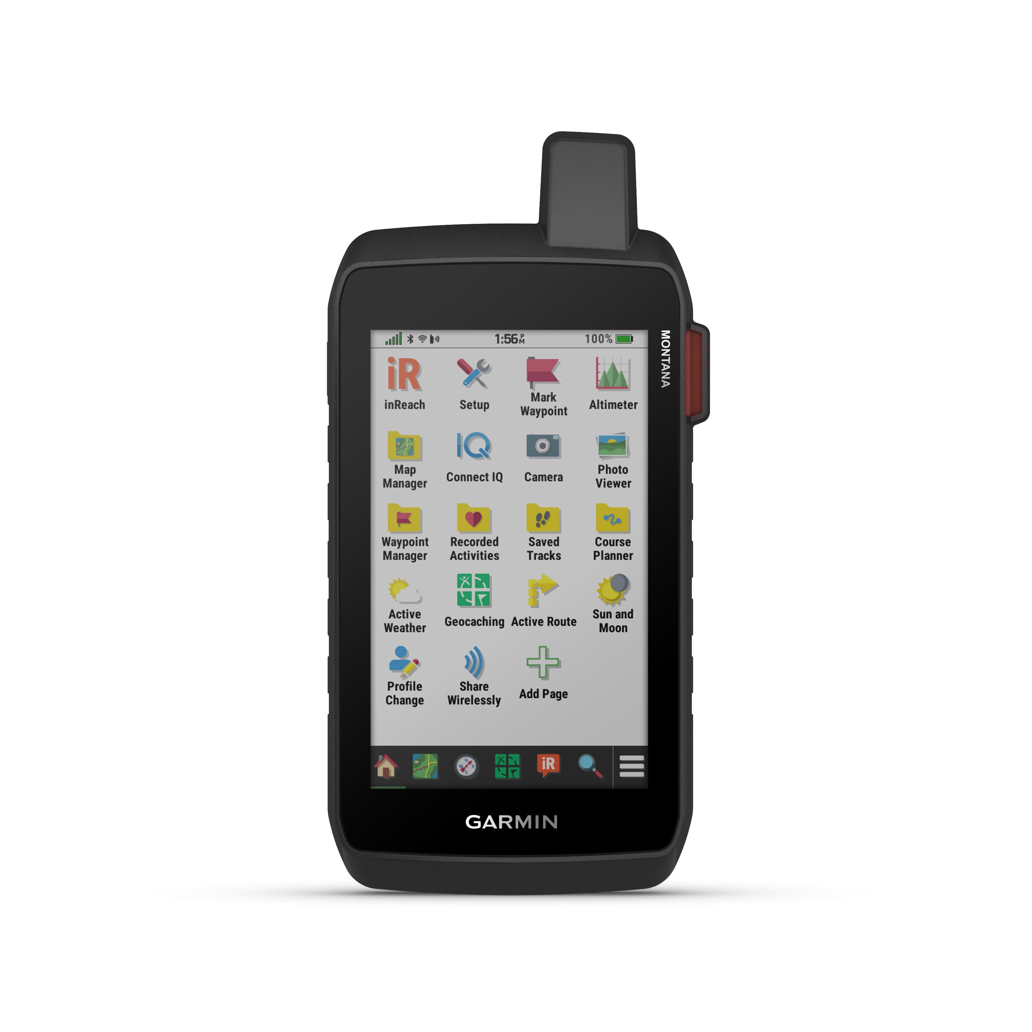
Garmin - Montana 760i 5" GPS with Built-in Bluetooth - Black
SKU: JXF9YF5RJ9Great piece of equipment, great features...Great device. I bought a month or so ago and I am so glad I did....Great addition to navigation needs
See all Portable GPSProduct Description
A rugged black handheld GPS with inReach messaging, 5" touchscreen, camera, and multi-GNSS support.Your price for this item is $697.99Save $202The previous price was $899.99 -
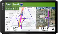
Garmin - Tread 2 - Overland Edition Powersport Navigator 8" GPS with Built-In Bluetooth - Black
SKU: JXF9YFFPJ8See all Portable GPSProduct Description
A rugged black GPS navigator with an 8" glove-friendly touchscreen, topographic maps, and built-in Bluetooth.Your price for this item is $999.99 -
Garmin - Montana 710 5" GPS with Built-in Bluetooth - Black
SKU: JXF9YF56VJSee all Portable GPSProduct Description
A rugged black handheld GPS with a 5" touchscreen, Bluetooth, TopoActive maps, and water resistance.Your price for this item is $538.99Save $111The previous price was $649.99 -
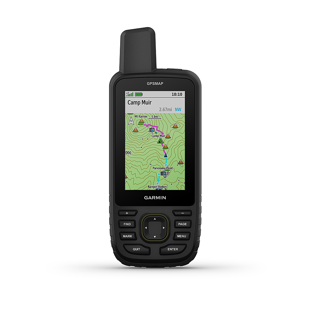
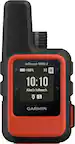
Garmin - GPSMAP 67i 3" GPS with Built-In Bluetooth - Black
SKU: JXF9YFZWZSSee all Portable GPSProduct Description
A rugged black handheld GPS with Bluetooth, two-way satellite messaging, preloaded maps, and emergency SOS features.Your price for this item is $799.95 -
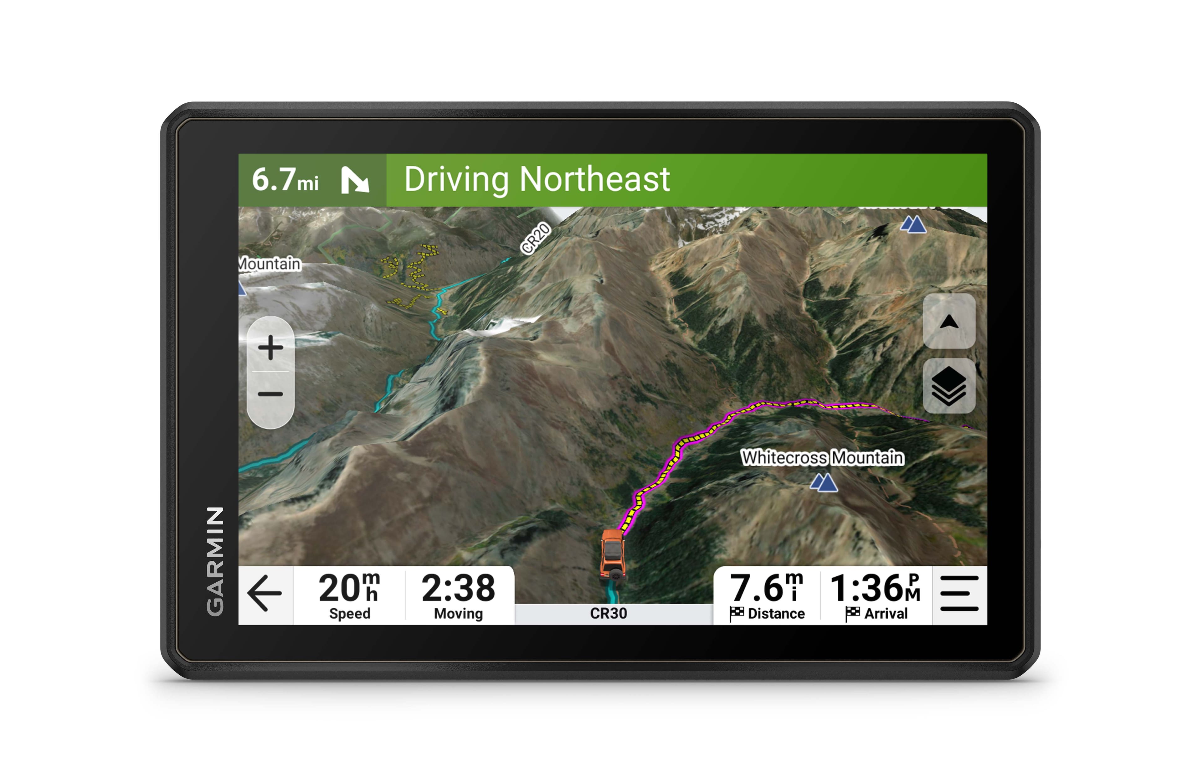
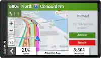
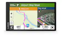
Garmin - RV 1095 10" GPS Navigator with Built-In Bluetooth - Black
SKU: JXF9YFZCZ3But when we are in motorhome it’s great , makes traveling so much easier and less stressful.
See all Portable GPSProduct Description
A black GPS navigator with a 10" touchscreen, Bluetooth, custom RV routing, and North America maps.Your price for this item is $864.99Save $35The previous price was $899.99 -
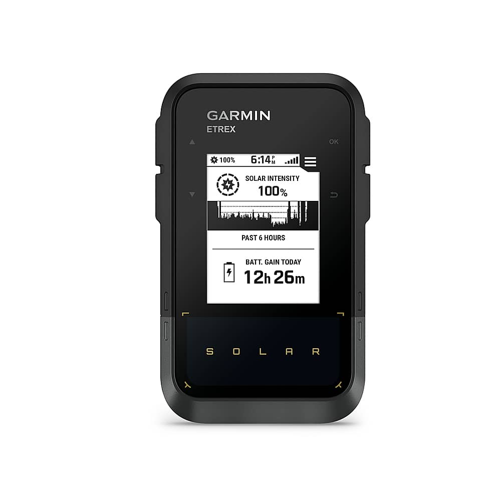
Garmin - eTrex Solar 2.2" GPS - Black
SKU: JXF9YF5J67Great device although it takes time getting used to operating it
See all Portable GPSProduct Description
A black handheld GPS navigator with solar charging, multi-band accuracy, water resistance, and app connectivity.Your price for this item is $249.99 -
Garmin - Tread 2 - SxS Edition Powersport Navigator 8" GPS with Built-In Bluetooth - Black
SKU: JXF9YFFPJFSee all Portable GPSProduct Description
A rugged black GPS navigator with an 8" glove-friendly touchscreen, Bluetooth, topographic maps, and water resistance.Your price for this item is $999.99 -
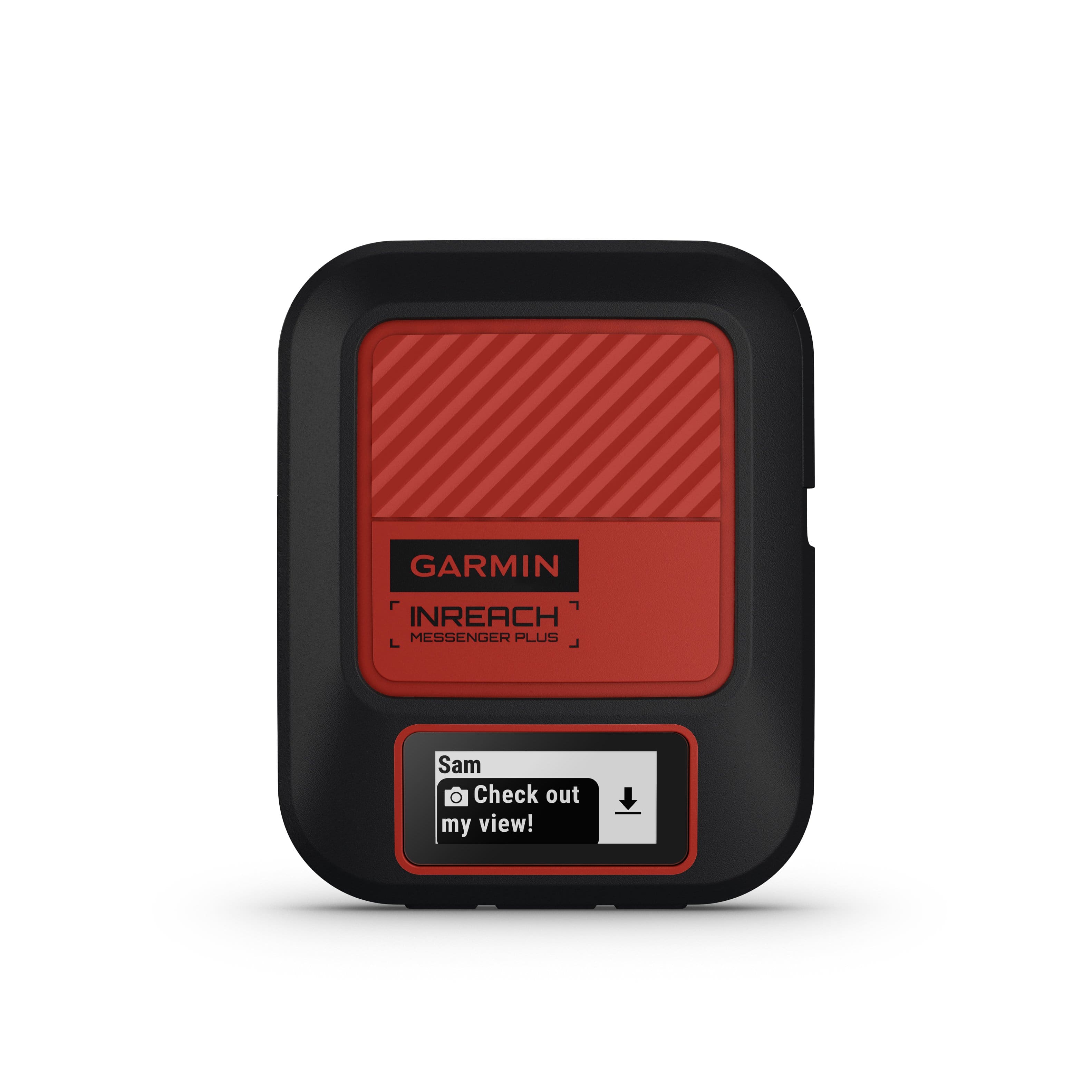
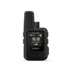
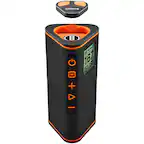
Garmin - inReach Messenger Plus SOS Satellite Communicator with Photo & Voice Messaging 1.08" GPS with Built-In Bluetooth - Black/Red
SKU: JXF9YF56GFGreat Investment for Peace of Mind...I still plan to use my phone and an external charger for maps, which is one of the reasons I love this...I wish that it was easier to let other family members use...
See all Portable GPSProduct Description
A black and red satellite communicator enabling photo, voice, and text messaging with SOS emergency features.Your price for this item is $305.99Save $94The previous price was $399.99

Best Sellers
Related Pages


FAQ
When choosing a GPS with satellite imagery, consider features such as high-resolution map displays, real-time traffic updates, offline map capabilities, touch-screen navigation, and compatibility with various map providers. Some models also offer advanced route planning, waypoint marking, and integration with mobile apps for enhanced usability.
Yes, many GPS devices with satellite imagery are designed for outdoor use and are ideal for hiking, camping, geocaching, and other adventures. Look for units that are rugged, water-resistant, and offer long battery life to ensure reliable performance in diverse environments.
Some GPS devices store satellite imagery maps locally, allowing you to access them without a data connection. However, updating or downloading new map data may require an internet connection. Always check the device specifications for offline map support.
Many modern GPS devices offer Bluetooth or Wi-Fi connectivity, allowing you to sync data, share routes, or receive notifications from your smartphone or tablet. Some devices also have companion apps for enhanced features and map management.
The frequency of satellite imagery updates depends on the manufacturer and the specific model. Some GPS devices offer regular updates through their software or companion apps. It's recommended to check for updates periodically to ensure you have the most current maps and imagery.