Outdoor Navigators
-
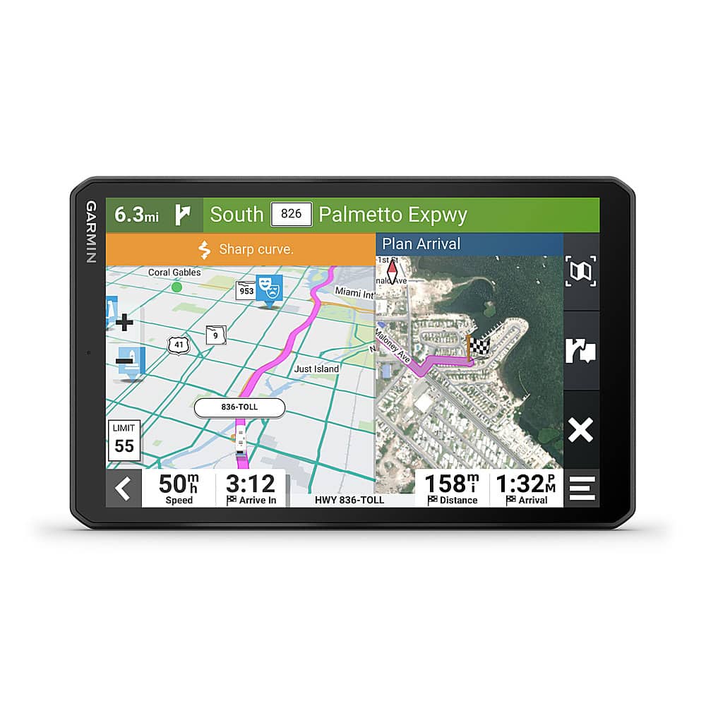
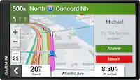
Garmin - RV 895 8" GPS Navigator with Built-In Bluetooth - Black
SKU: JXF9YFZCKYBest gift...I just fall in love with my Garmin RV 895 gps navigator with many functions....Great rv gps...Love everything about it. Easy to use and does what I need. Great for rv traveling
See all Portable GPSProduct Description
A black GPS navigator with an 8" touchscreen, Bluetooth, RV-specific routing, and North America maps.Your price for this item is $669.95Save $30The previous price was $699.99 -
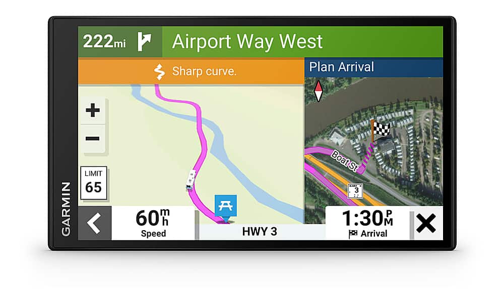
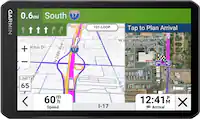
Garmin - RV 795 7" RV GPS Navigator - Black
SKU: JXF9YFZCWXmoved up from a old tom tom and its been great on our trips best on market (rv 795) and size was great...Best Garmin RV - Great new functions & ease of use
See all Portable GPSProduct Description
A black GPS navigator with a 7" touchscreen, custom RV routing, and North America map updates.Your price for this item is $344.99Save $105The previous price was $449.99 -
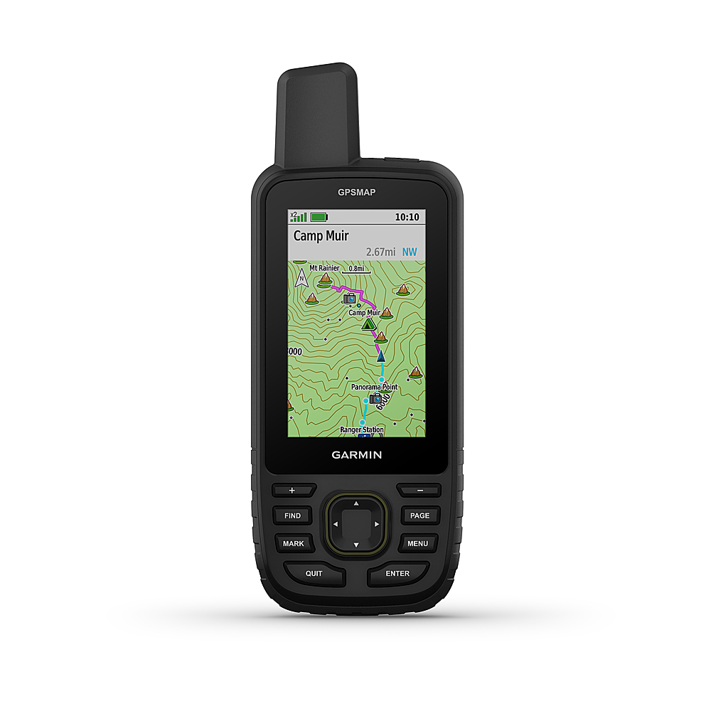
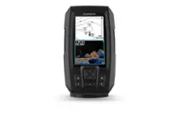
Garmin - GPSMAP 67 3" GPS with Built-In Bluetooth - Black
SKU: JXF9YFZW5FSee all Portable GPSProduct Description
A rugged black handheld GPS with multi-band GNSS, Bluetooth, color display, and advanced mapping features.Your price for this item is $499.99 -
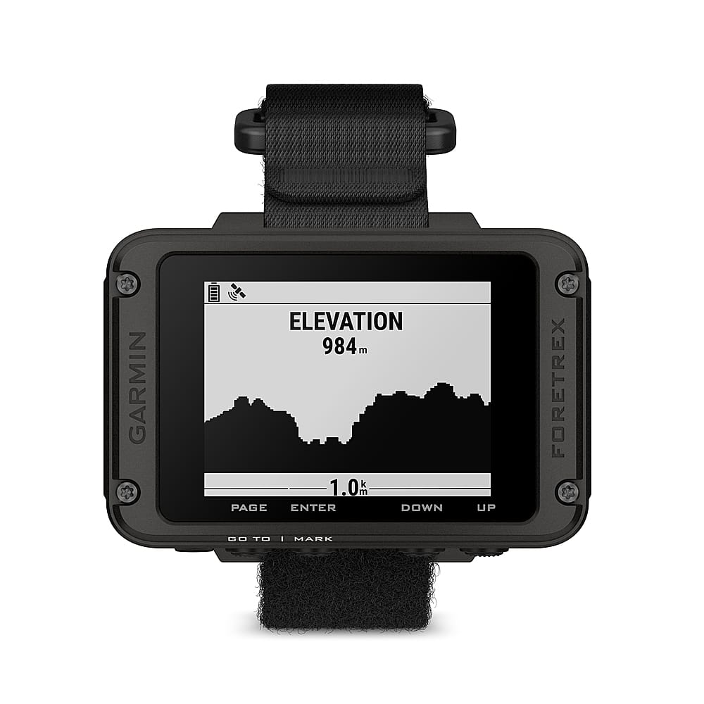
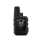
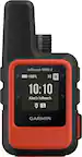
Garmin - Foretrex 801 GPS Smartwatch Navigator with Strap 73 mm Fiber-Reinforced Polymer - Black - (2023)
SKU: JXF9YF4GGLSee all All SmartwatchesProduct Description
A rugged black fiber-reinforced polymer GPS smartwatch with tactical features, multi-band accuracy, and long battery life.Your price for this item is $249.99 -
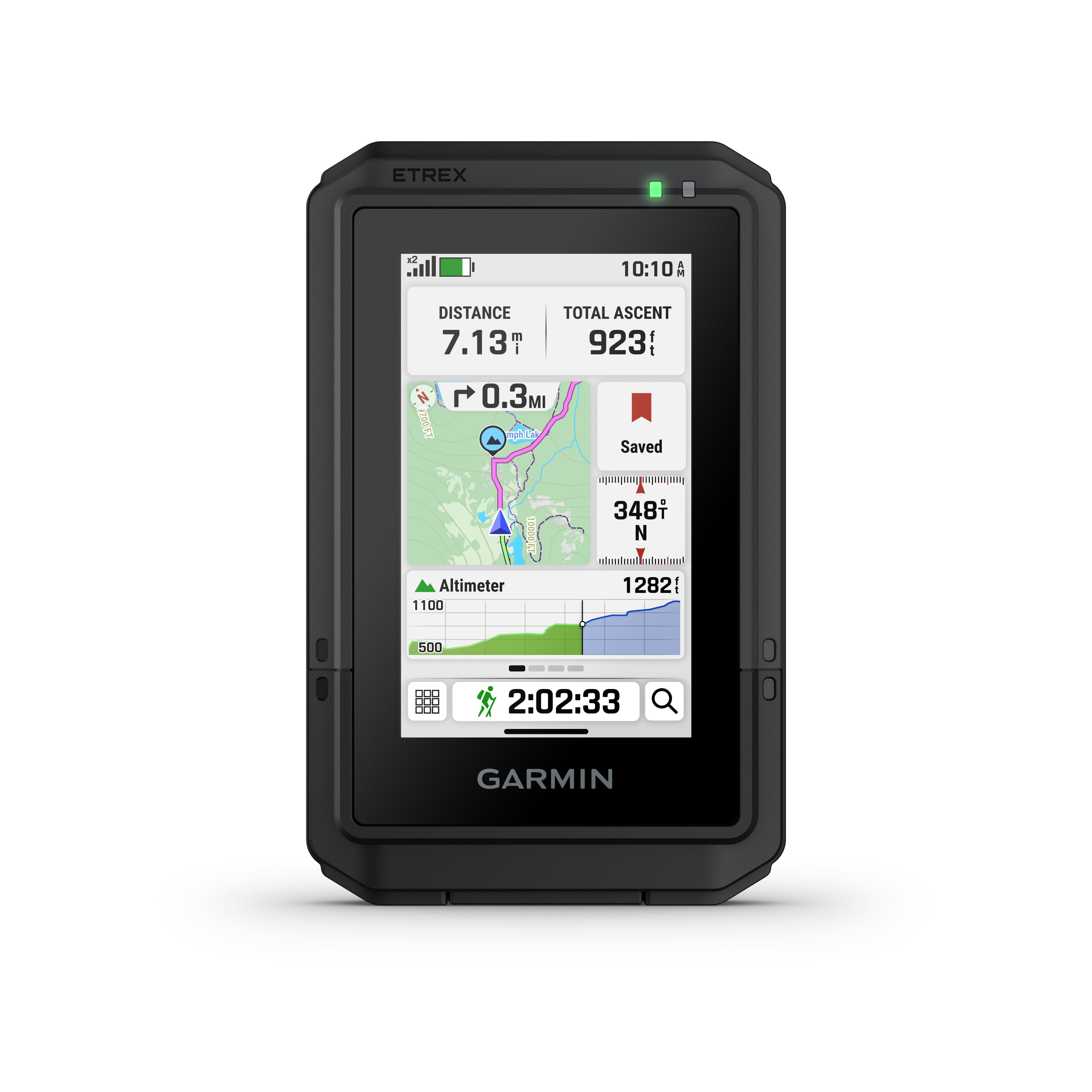
Garmin - eTrex Touch 3" GPS Handheld Outdoor Navigator with Preloaded Maps for North America and Built-In Bluetooth - Black
SKU: JXF9YFFXFSThe long battery life and the WiFi and Bluetooth capability are great.
See all Portable GPSProduct Description
A rugged black handheld GPS with a 3" color touchscreen, Bluetooth, and multi-band satellite support.Your price for this item is $349.99Save $100The previous price was $449.99 -
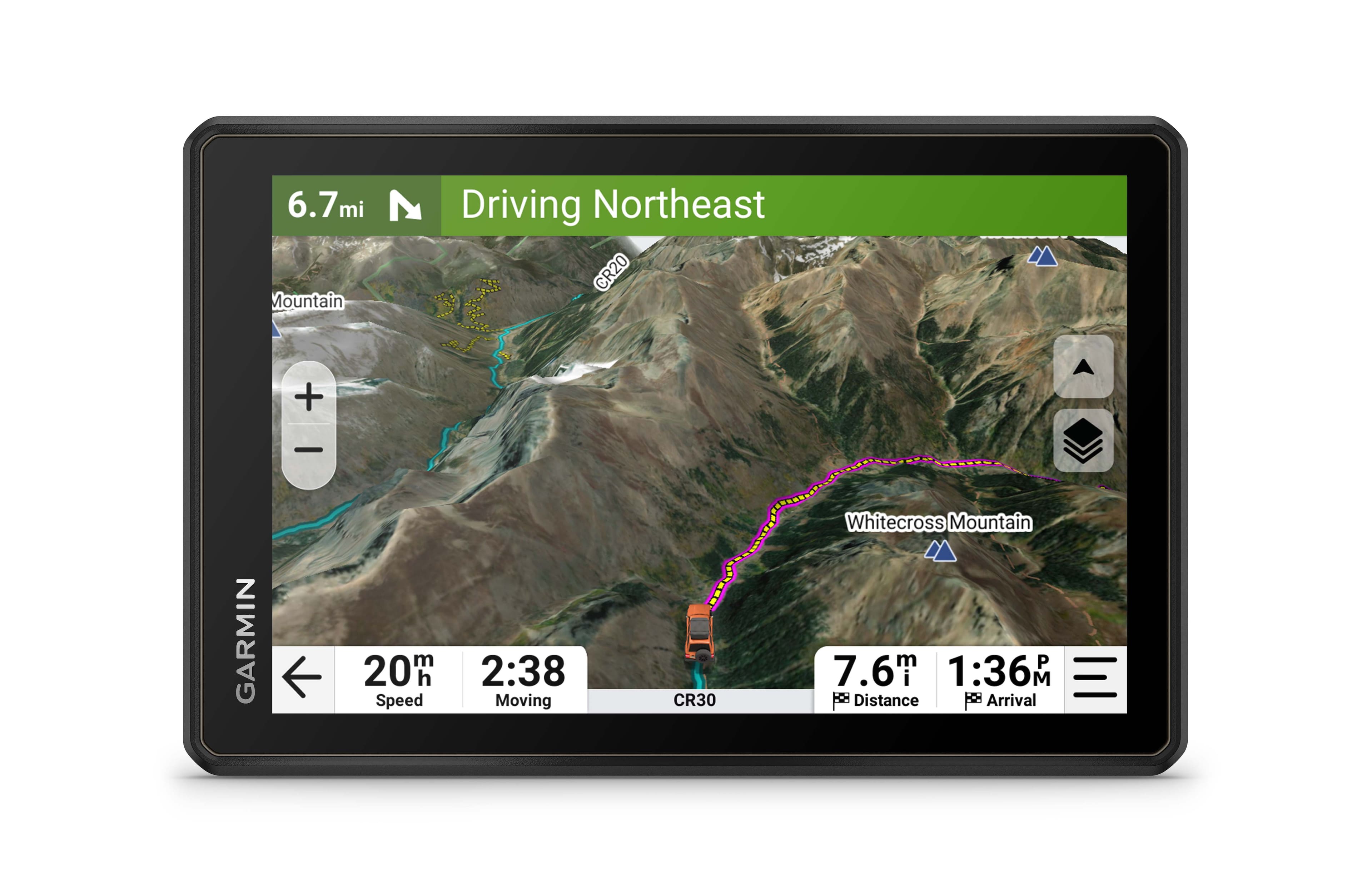
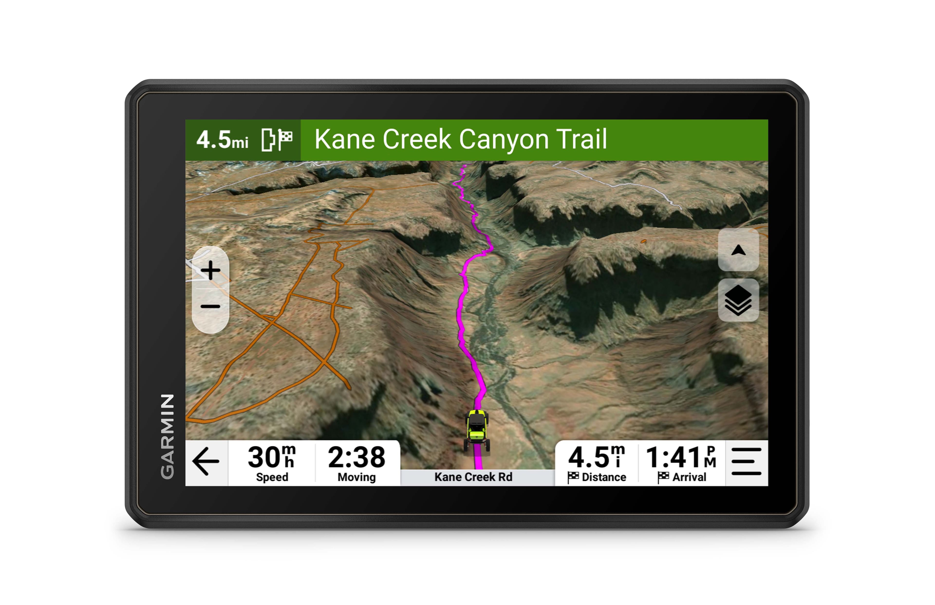
Garmin - Tread 2 - Overland Edition Powersport Navigator 8" GPS with Built-In Bluetooth - Black
SKU: JXF9YFFPJ8See all Portable GPSProduct Description
A rugged black GPS navigator with an 8" glove-friendly touchscreen, topographic maps, and built-in Bluetooth.Your price for this item is $999.99 -
Garmin - Montana 710 5" GPS with Built-in Bluetooth - Black
SKU: JXF9YF56VJSee all Portable GPSProduct Description
A rugged black handheld GPS with a 5" touchscreen, Bluetooth, TopoActive maps, and water resistance.Your price for this item is $538.99Save $111The previous price was $649.99 -
Garmin - Tread 2 - SxS Edition Powersport Navigator 8" GPS with Built-In Bluetooth - Black
SKU: JXF9YFFPJFSee all Portable GPSProduct Description
A rugged black GPS navigator with an 8" glove-friendly touchscreen, Bluetooth, topographic maps, and water resistance.Your price for this item is $899.99Save $100The previous price was $999.99 -
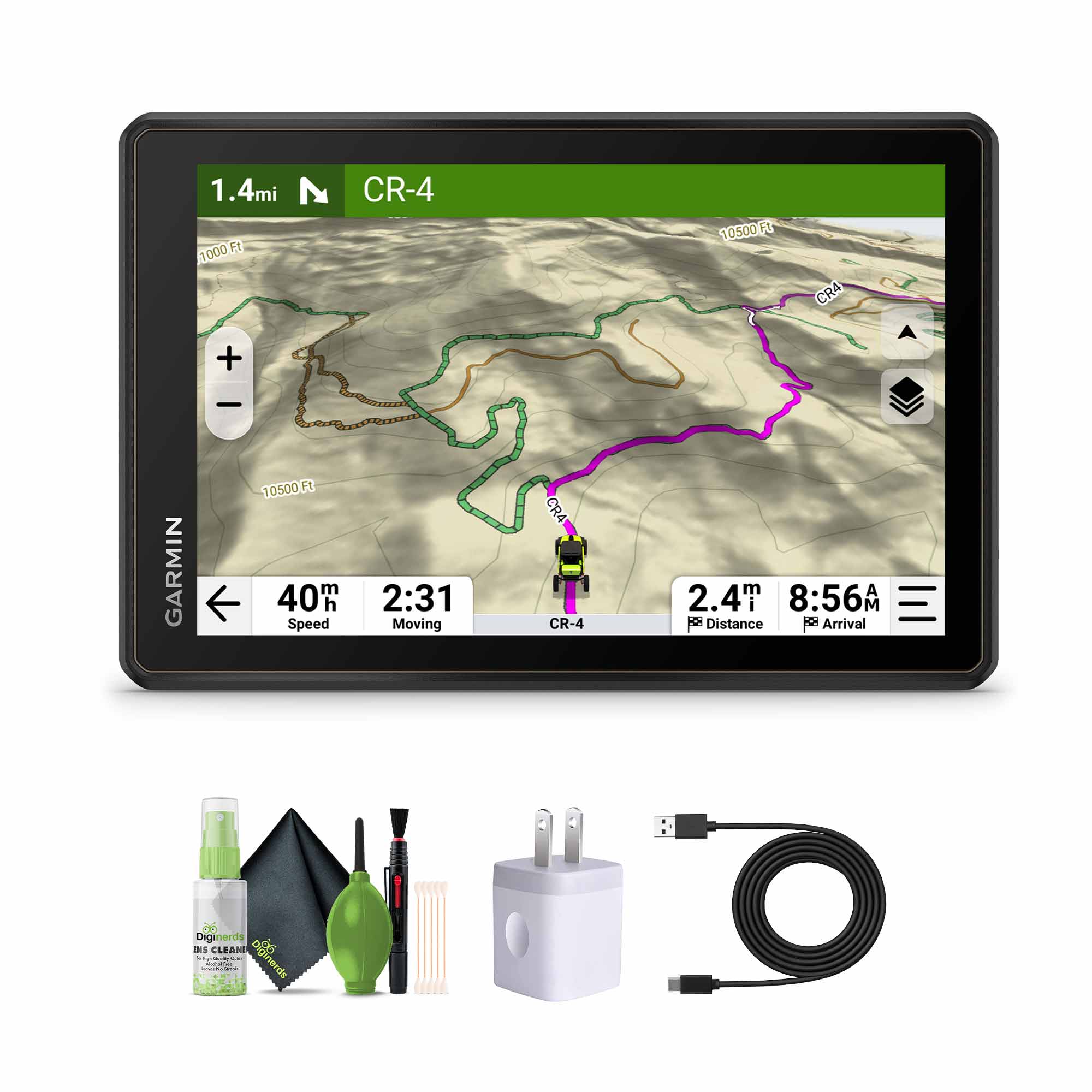
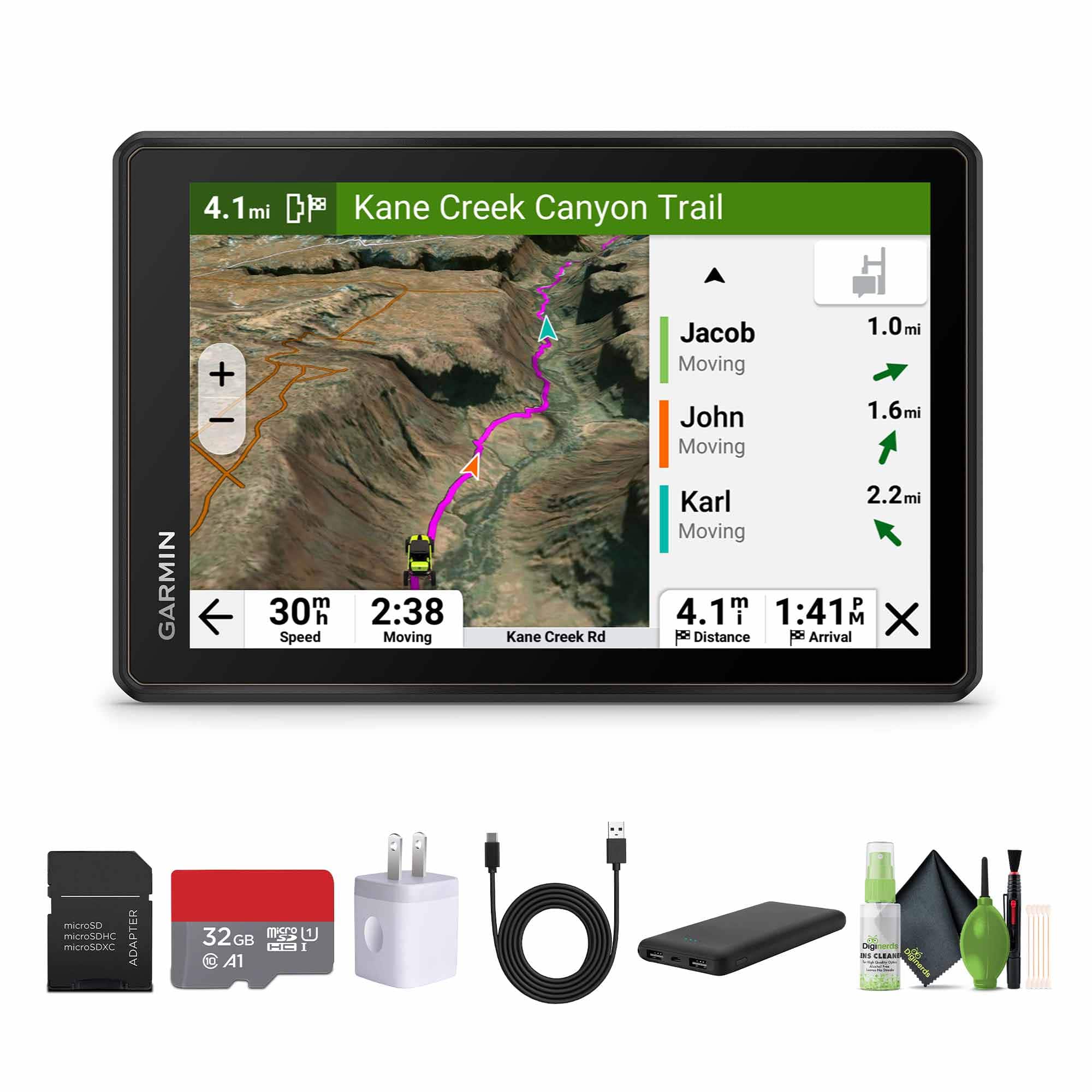
Garmin - Tread 2 Overland Edition 8in GPS Navigator Bundle - Black
SKU: J7QPQZWVJYSee all Portable GPSProduct Description
A rugged black GPS navigator with an ultrabright 8-inch touchscreen, ideal for off-grid and overland adventures.Your price for this item is $1,019.99 -
Garmin - Tread 2 Overland GPS Bundle with 32GB Memory Card - Black
SKU: J7QPQZWVJHSee all Portable GPSProduct Description
A rugged black all-terrain GPS navigator with an 8-inch touchscreen, weather-sealed design, and advanced off-road mapping.Your price for this item is $1,019.99

Best Sellers
Related Pages
FAQ
At Best Buy, you’ll find a wide range of outdoor navigators including handheld GPS devices, GPS watches, hiking navigation tools, and cycling GPS units from trusted brands. These devices are designed for various outdoor activities such as hiking, biking, geocaching, and boating.
Yes, most outdoor navigators use satellite signals for positioning and navigation, allowing them to function in remote areas without the need for a cellular connection or Wi-Fi.
Many outdoor navigators available at Best Buy come preloaded with topographic maps or offer the ability to download and install detailed maps, including terrain contours, trails, and landmarks.
Yes, several models feature integrated digital compasses, barometric altimeters, and even weather sensors to help you navigate and monitor your environment more effectively.
Many outdoor navigators offer Bluetooth or Wi-Fi connectivity, allowing you to sync with your smartphone for features like notifications, route planning, and activity tracking through companion apps.