Garmin - GPSMAP 65s 2.6" GPS with Built-in Bluetooth - Black
About this product
Find your way in this big, wide world with GPSMAP 65s. This rugged handheld offers multi-band technology and expanded GNSS support for optimal accuracy in steep country, urban canyons and forests with dense trees. It has a 2.6” color display, button-operated design, routable TopoActive mapping and ABC (altimeter, barometer and compass) sensors. Wireless connectivity through BLUETOOTH and ANT+ technologies provides compatibility with the Garmin Explore website and app (compatible smartphone required) to help you manage tracks, routes and waypoints and review statistics from the field.
Preloaded Topo Maps
Preloaded TopoActive U.S. and Canada maps show you terrain contours, topographic elevations, summits, parks, coastlines, rivers, lakes and geographical points.
Bluetoth Enabled
Receive emails, texts and alerts right on your handheld when paired with your compatible device.
Color Display
Don’t miss a detail with this large, sunlight-readable 2.6" color display.
Multi Band Frequency Support
Receive and utilize multiple frequencies sent by navigation satellites which enables improved user position accuracy, specifically in areas where GNSS signals are reflected, weak or typically do not penetrate.
Public Land Boundaries
An optional display of federal public land boundaries on topographical maps helps you know that you’re venturing where you’re supposed to be.
Smart Notifications
Receive emails, texts and alerts right on your handheld when paired with your compatible device.
Garmin Explore App
Plan, review and sync waypoints, routes and tracks by using the Garmin Explore app* and website. You can even review completed activities while still in the field.
Geocaching
Get paperless geocaches by uploading GPX files straight to your device. View key information such as location, terrain and hints from Geocaching.com.
Disclaimer
Traffic content not available for all areas. See www.navteq.com/rdstraffic for traffic coverage areas
Disclaimer
Many of the “updates” and “live information” features are only available when connected to an Internet-enabled smartphone
Disclaimer
Additional fees may apply.
- Screen Size2.6 inchesTouch ScreenYes3D-Map ViewYesLifetime Map UpdatesYesTopographic MapsYesProgrammable RoutesYes
Reviews
Rating 2.5 out of 5 stars with 2 reviews
The vast majority of our reviews come from verified purchases. Reviews from customers may include My Best Buy members, employees, and Tech Insider Network members (as tagged). Select reviewers may receive discounted products, promotional considerations or entries into drawings for honest, helpful reviews.
Compare similar products
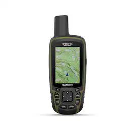
Find your way in this big, wide world with GPSMAP 65s. This rugged handheld offers multi-band technology and expanded GNSS support for optimal accuracy in steep country, urban canyons and forests with dense trees. It has a 2.6” color display, button-operated design, routable TopoActive mapping and ABC (altimeter, barometer and compass) sensors. Wireless connectivity through BLUETOOTH and ANT+ technologies provides compatibility with the Garmin Explore website and app (compatible smartphone required) to help you manage tracks, routes and waypoints and review statistics from the field.
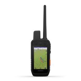
Lead your pack with the Alpha® 300i dog tracking and training handheld. It features inReach® satellite technology for two-way messaging and interactive SOS alerts (active subscription required; jurisdiction restrictions may apply). Track and train up to 20 dogs from up to 9 miles when paired with your compatible dog collars. See it all on a vivid 3.5” touchscreen display with up to a 2.5-second update rate. Easily control training functions using the button-operated design, which gives you 18 levels of stim, tone or vibration when paired to your training-enabled collar. Access premium Garmin navigation features, such as preloaded TopoActive maps, satellite imagery, and a built-in 3-axis compass and barometric altimeter. With up to 50 hours of battery life, you don’t have to worry about running out of power before your dogs do.

Tap into adventure with the rugged, easy-to-use eTrex Touch GPS handheld navigator. With a bright 3" high-resolution color touchscreen, it’s sunlight readable so you don’t miss a detail. It’s purpose-built for exploration in any weather (IP67 water rating) and comes with maps for trails and roads so you can easily swipe and zoom to follow your route. Add ongoing access to Outdoor Maps+ (sold separately) for a variety of premium mapping content, and get up to 130 hours of battery life in all satellite systems plus multi-band mode (assuming typical use with SatIQ technology) to enjoy all your favorite outdoor activities even more. Multi-band GPS support provides optimal positional accuracy, so you know exactly where you are. Use the Garmin Explore mobile app for convenient trip planning and more.
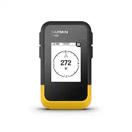
Ready. Set. Hike. With the eTrex SE GPS handheld navigator, you’ll get battery life that lasts up to 168 hours with 2 AA batteries (not included). You’ll view waypoints, track your location and find your way back to favorite spots on the 2.2” high-resolution screen. You can pair it with the Garmin Explore app on your compatible smartphone for wireless software updates, Geocaching Live, wireless connectivity for cloud storage, Active Weather, smart notifications and more. It’s water-resistant (rated to IPX7) and offers multi-GNSS support to track in more challenging environments than GPS alone. With a digital compass that’s accurate even while standing still, it provides what you need to enjoy the outdoors more.
Specs
Is the 65s USB compatiable with Windows 22H2? My old 60CSx can no longer communicate after this last Win update to download trip logs?
Answered by GarminProductExpertYes, the GPSMAP 65s is compatible with Windows 10 and Windows 11. For more information please view our Support Center, https://support.garmin.com/en-US/. You can also contact Product Support or email us at product.support@garmin.com. Garmin

do I have to by a yearly subscription?
Answered by GarminProductExpertThe GPSMAP 65s does not have inReach capabilities. It also doesn't have Birdseye Imagery. For more information please view our Support Center, https://support.garmin.com/en-US/. You can also contact Product Support or email us at product.support@garmin.com. Thanks Jenny
Enjoy your ride Sponsored
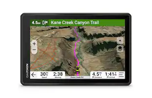 $899.99The price was $999.99
Discover related products


Keep exploring
 $1,325.98The price was $1,349.95
 $464.99The price was $502.93