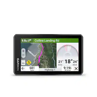
Garmin - eTrex Touch 3" GPS Handheld Outdoor Navigator with Preloaded Maps for North America and Built-In Bluetooth - Black
More Buying Options from Best Buy and Marketplace sellers
Related Item

Specifications
- Screen Size3 inchesTouch ScreenYes3D-Map ViewYesTopographic MapsYesPoints Of Interest15000Programmable RoutesYes
- Key Specs
- Screen Size: 3 inches (Size of the screen, measured diagonally from corner to corner.)
- Touch Screen: true (Touch-screen devices make navigating more intuitive. Using a touch-screen display, you can do things such as tap to select, hold and drag to move items, swipe to scroll, and pinch to zoom.)
- 3D-Map View: true
- Topographic Maps: true
- Points Of Interest: 15000
- Programmable Routes: true
- Alerts: Incoming call, Incoming text
- Integrated Camera: false
- App Compatible: true (The product can be connected to a program or software application on a mobile device, which then receives collected data from the product.)
- Wi-Fi Built-in: true (Able to connect directly to a wireless network without the use of an adapter.)
- General
- Brand: Garmin
- Model Number: 010-02940-00
- Product Name: eTrex Touch 3" GPS Handheld Outdoor Navigator with Preloaded Maps for North America and Built-In Bluetooth
- Color: Black
- Designed Usage: Geocaching, Hiking, Hunting, Outdoor
- Case Included: false
- Display
- Screen Size: 3 inches (Size of the screen, measured diagonally from corner to corner.)
- Touch Screen: true (Touch-screen devices make navigating more intuitive. Using a touch-screen display, you can do things such as tap to select, hold and drag to move items, swipe to scroll, and pinch to zoom.)
- Color Display: true
- 3D-Map View: true
- Resolution: 240 x 400 (Refers to the number of pixels, both horizontally and vertically, used to capture video/images. The higher the resolution the finer the detail that can be seen.)
- Backlit Display: true (Integrated lights allow for visibility of the display in low-light conditions.)
- Display Type: TFT
- Map
- Integrated Base Maps: true
- Map Coverage Area: North America
- Map Sharing: true
- Geocaching Mode: true
- Topographic Maps: true
- Uploadable Maps: true
- Navigation
- Points Of Interest: 15000
- Programmable Routes: true
- Voice Prompts: false
- Emergency Services Locator: true
- Electronic Compass: true
- Environmental
- Water Resistant: true (Resists some degree of water penetration.)
- Maximum Depth Of Water Resistance: 3 feet (Measurement of the maximum depth of water in which the product is able to resist some degree of water penetration.)
- Barometric Altimeter: true
- Sun/Moon Information: true
- Temperature Display: true
- Features
- Location Reporting: true
- Alerts: Incoming call, Incoming text
- Integrated Camera: false
- Pedestrian Mode: true
- Hand Strap: false
- Text-To-Speech: false (A system that converts language text into speech.)
- MP3 Playback: false
- Storage
- Built-in Storage: 32 gigabytes
- Expandable Storage: false
- Compatibility
- App Compatible: true (The product can be connected to a program or software application on a mobile device, which then receives collected data from the product.)
- Computer Compatibility: Android, Apple iOS
- Unit-To-Unit Transfer: true
- Automatic Sync: true
- Voice Assistant Built-in: No (A digital assistant built into the device that uses voice commands to answer questions and control smart devices.)
- Connectivity
- Bluetooth Enabled: true (The device is capable of communicating with another device via Bluetooth, provided they are within the required range of each other. A Bluetooth-enabled device must also be the same Bluetooth version or higher than the accessory it is intended to pair with.)
- Number Of USB Port(s): 1 (The total number of USB ports including all generations and versions.)
- Wi-Fi Built-in: true (Able to connect directly to a wireless network without the use of an adapter.)
- Dimensions
- Product Height: 4.15 inches (The out of box height of the item. Height is measured as the vertical distance from the bottom of the item to the top as it would be primarily used or placed.)
- Product Width: 2.6 inches (The out of box width of the item. Width is measured as the horizontal distance from one side of the item to the other as it would be primarily used or placed.)
- Product Depth: 0.97 inches (The out of box depth of the item. Depth is measured as the distance from the front of the item to the back as it would be primarily used or placed.)
- Product Weight: 0.33 pounds (The out of box weight of the item.)
- Power
- Rechargeable Battery: true
- Battery Life: 130 hours (Battery life will vary depending on the product configuration, product model, applications loaded on the product, power management setting of the product and the product features used by the customer. As with all batteries, the maximum capacity of this battery will decrease with time and usage.)
- Battery Chemistry: Lithium-ion
- Interface(s): USB-C (Refers to the types of connections that devices use to interact and communicate with each other.)
- Charging Method: USB
- Mounting
- Mount Included: false
- Warranty
- Warranty - Parts: 1 year limited
- Warranty - Labor: 1 year limited
- Other
- UPC: 753759346836
Tap into adventure with the rugged, easy-to-use eTrex Touch GPS handheld navigator. With a bright 3" high-resolution color touchscreen, it’s sunlight readable so you don’t miss a detail. It’s purpose-built for exploration in any weather (IP67 water rating) and comes with maps for trails and roads so you can easily swipe and zoom to follow your route. Add ongoing access to Outdoor Maps+ (sold separately) for a variety of premium mapping content, and get up to 130 hours of battery life in all satellite systems plus multi-band mode (assuming typical use with SatIQ technology) to enjoy all your favorite outdoor activities even more. Multi-band GPS support provides optimal positional accuracy, so you know exactly where you are. Use the Garmin Explore mobile app for convenient trip planning and more.
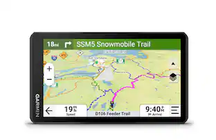
- Touchscreen: The slim, pocket-size handheld navigator features a bright 3-inch high-resolution color touchscreen so you can easily swipe and zoom to follow your route.
- Rugged design: The eTrex Touch navigator is purpose-built with an IP67 water rating and impact-resistant (MIL-STD-810) design to withstand weather and rugged conditions.
- Preloaded maps: View detailed TopoActive maps for roads and trails, and see terrain contours, topographic elevations, summits, parks, rivers, lakes and geographical points plus thousands of points of interest. Plus, get easy access to additional TopoActive mapping around the globe.
- Outdoor Maps+: Purchase a subscription to Outdoor Maps+ for ongoing access to a wide variety of premium mapping content, including satellite imagery, campgrounds and more. Download and receive automatic updates via Wi-Fi technology.
- Plan and review your trip: Connect with the Garmin Explore app to plan and review trip data on your smartphone or tablet and manage your waypoints, courses and activities.
- Weather: Get real-time forecast information so you are aware of the changing conditions. This feature requires an active internet or Wi-Fi connection, or use of the Garmin Explore app on your paired smartphone.
- Battery life: Get long battery life up to 130 hours in all satellite systems plus multi-band mode, assuming typical use with SatIQ technology; and up to 650 hours in expedition mode.
Whats Included
- eTrex Touch
- Charging/data cable
- Documentation
Q: Does this GPS device have built-in Wi-Fi?
A: Yes, this GPS device has built-in Wi-Fi.
Q: Can this outdoor navigator show temperature?
A: Yes, this outdoor navigator can display temperature.
Q: Is the battery rechargeable in this GPS device?
A: Yes, the battery is rechargeable in this GPS device.
Q: What is the battery life of this GPS navigator?
A: The battery life is up to 130 hours.
Q: Are topographic maps available on this navigator?
A: Yes, topographic maps are available on this navigator.
Q: Does this GPS navigator have bluetooth?
A: Yes, this GPS navigator is bluetooth enabled.
Q: Does this GPS handheld device have a touch screen?
A: Yes, this GPS handheld device features a touch screen.
Compare similar products

Tap into adventure with the rugged, easy-to-use eTrex Touch GPS handheld navigator. With a bright 3" high-resolution color touchscreen, it’s sunlight readable so you don’t miss a detail. It’s purpose-built for exploration in any weather (IP67 water rating) and comes with maps for trails and roads so you can easily swipe and zoom to follow your route. Add ongoing access to Outdoor Maps+ (sold separately) for a variety of premium mapping content, and get up to 130 hours of battery life in all satellite systems plus multi-band mode (assuming typical use with SatIQ technology) to enjoy all your favorite outdoor activities even more. Multi-band GPS support provides optimal positional accuracy, so you know exactly where you are. Use the Garmin Explore mobile app for convenient trip planning and more.

Explore with confidence with eTrex 32x, a rugged GPS handheld with preloaded maps and a 2.2” sunlight-readable color display. It comes with TopoActive mapping featuring routable roads and trails to explore when hiking or cycling. Add even more maps via the microSD card slot and 8 GB of internal memory. With dual-satellite support (GPS and GLONASS) and a 3-axis compass and barometric altimeter, it tracks in more challenging environments than GPS alone.

Stay on track and in touch with the rugged Montana 710i handheld GPS navigator with inReach technology. Built to guide you through all kinds of adventures, it includes TopoActive mapping and a glove-friendly 5” color touchscreen. When you go beyond the limits of cell service, stay connected with inReach technology for two-way text messaging, live tracking and interactive SOS alerts to the Garmin Response team, a 24/7-staffed international emergency response coordination center (active subscription required; some jurisdictions regulate or prohibit the use of satellite communication devices). Expanded 32 GB memory capacity lets you store more maps to keep your expeditions on course. High-resolution satellite imagery, available via subscription-free, direct-to-device downloads (requires a connection with Wi-Fi technology), shows a clear overhead view of your route and surrounding terrain. Get the on- or off-road capabilities you need with multi-GNSS support and ABC sensors. Add ongoing access to Outdoor Maps+ (sold separately) for a wide variety of premium mapping content. Explore longer with up to 24 hours of battery life in GPS mode and up to 432 hours in ultralow-powered expedition mode, and recharge easily with a standard USB-C cable. Plus, Montana 710i meets MIL-STD 810 for thermal, shock and vibration and is rated IPX7 for water-resistance
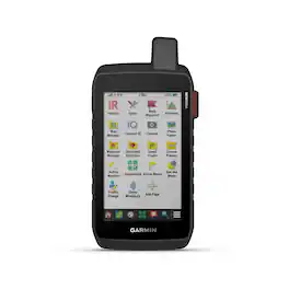
Stay on track and in touch with the rugged Montana 760i handheld GPS navigator with inReach technology. Built to guide you through all kinds of adventures, it includes TopoActive mapping and a glove-friendly 5” color touchscreen. When you go beyond the limits of cell service, stay connected with inReach technology for two-way messaging, live tracking and interactive SOS alerts to the Garmin Response team, a 24/7-staffed international emergency response coordination center (active subscription required; some jurisdictions regulate or prohibit the use of satellite communication devices). Capture and tag the location of your photos along the way with the built-in camera. Expanded 32 GB memory capacity lets you store more maps to keep your expeditions on course. High-resolution satellite imagery, available via subscription-free, direct-to-device downloads (requires a connection with Wi-Fi technology), shows a clear overhead view of your route and surrounding terrain. Get the on- or off-road capabilities you need with multi-GNSS support and ABC sensors. Add ongoing access to Outdoor Maps+ (sold separately) for a wide variety of premium mapping content. Explore longer with up to 24 hours of battery life in GPS mode and up to 432 hours in ultralow-powered expedition mode, and recharge easily with a standard USB-C cable. Plus, Montana 760i meets MIL-STD 810 for thermal, shock and vibration and is rated IPX7 for water-resistance.
Specs
Reviews
Rating 5 out of 5 stars with 1 review
The vast majority of our reviews come from verified purchases. Reviews from customers may include My Best Buy members, employees, and Tech Insider Network members (as tagged). Select reviewers may receive discounted products, promotional considerations or entries into drawings for honest, helpful reviews.
Enjoy your ride Sponsored
 $312.99The price was $349.99
 $899.99The price was $999.99
 $268.99The price was $299.99